Alpes
The towns and their communes which surround Mont Blanc are Courmayeur in Aosta Valley, Italy; and Saint-Gervais-les-Bains and Chamonix in Haute-Savoie, France. The latter town was the site of the first Winter Olympics. A cable car ascends and crosses the mountain range from Courmayeur to Chamonix through the Col du Géant. The 11.6 km (7+1⁄4 mi) Mont Blanc Tunnel, constructed between 1957 and 1965, runs beneath the mountain and is a major transalpine transport route.
The Alpine arch extends from Nice on the western Mediterranean to Trieste on the Adriatic and Vienna at the beginning of the Pannonian Basin. The mountains were formed over tens of millions of years as the African and Eurasian tectonic plates collided. Extreme shortening caused by the event resulted in marine sedimentary rocks rising by thrusting and folding into high mountain peaks such as Mont Blanc and the Matterhorn.
The massif has been an important source of mineral specimens for crystal-hunters for over 250 years. The mountaineer and explorer, Edward Whymper, noted that the basin of the Glacier de Talèfre was "considered good hunting-ground for crystals", and that the slopes below les Courtes had yielded many large specimens. He recounted that in 1745 a guide had stated he had collected over 300 pounds (136 kg) of specimens there in just three hours. The first systematic account of the minerals of the Mont Blanc area was published in 1873 by Venance Payot. His list, entitled "Statistique minéralogique des environs du Mt-Blanc", catalogued 90 mineral types although it also included those present only as very small components of rocks.. The three towns and their communes which surround Mont Blanc are Courmayeur in Aosta Valley, Italy; and Saint-Gervais-les-Bains and Chamonix in Haute-Savoie, France. The latter town was the site of the first Winter Olympics.
The best weather for mountaineering or hiking occurs between late June to early October but, being the highest part of the Alps, the Mont Blanc massif can create its own weather patterns. Temperatures drop as the mountains gain in height, and the summit of Mont Blanc is a permanent ice cap. The summit is also prone to strong winds and sudden weather changes. Because of the massif's great overall height, a considerable proportion is permanently glaciated or snow-covered and is exposed to extremely cold conditions. Even on the high passes of the Tour du Mont Blanc, around 2,000 to 2,500 m (6,600 to 8,200 ft), summer temperatures can be between 5 and 15 °C (41 and 59 °F), but feeling much colder because of wind chill in windy or wet conditions. His list, entitled "Statistique minéralogique des environs du Mt-Blanc", catalogued 90 mineral types although it also included those present only as very small components of rocks.. The three towns and their communes which surround Mont Blanc are Courmayeur in Aosta Valley, Italy; and Saint-Gervais-les-Bains and Chamonix in Haute-Savoie, France. The latter town was the site of the first Winter Olympics.
The seamount chain, containing over 80 identified undersea volcanoes, stretches about 6,200 km (3,900 mi) from near the Aleutian Trench off the coast of the Kamchatka peninsula in the far northwest Pacific to the Kamaʻehuakanaloa Seamount (formerly Lōʻihi), the youngest volcano in the chain, which lies about 35 kilometres (22 mi) southeast of the Island of Hawaiʻi. The chain can be divided into three subsections. The first, the Hawaiian archipelago (also known as the Windward isles), consists of the islands comprising the U.S. state of Hawaii. As it is the closest to the hotspot, this volcanically active region is the youngest part of the chain, with ages ranging from 400,000 years
The Hawaiian–Emperor seamount chain is a mostly undersea mountain range in the Pacific Ocean that reaches above sea level in Hawaii. It is composed of the Hawaiian ridge, consisting of the islands of the Hawaiian chain northwest to Kure Atoll, and the Emperor Seamounts: together they form a vast underwater mountain region of islands and intervening seamounts, atolls, shallows, banks and reefs along a line trending southeast to northwest beneath the northern Pacific Ocean.
Politically, the peninsula forms part of Kamchatka Krai. The southern tip is called Cape Lopatka. (Lopatka is Russian for spade.) The circular bay to the north of this on the Pacific side is Avacha Bay, home to the capital, Petropavlovsk-Kamchatsky. Northward up the Pacific side, the four peninsulas are called Shipunsky Point, Kronotsky Point, Kamchatsky Point, and Ozernoy Point. North of Ozernoy Point is the large Karaginsky Bay, which features Karaginsky Island. Northeast of this (off the displayed map) lies Korfa Bay with the town of Tilichiki. On the opposite side is the Shelikhov Gulf.the youngest volcano in the chain, which lies about 35 kilometres (22 mi) southeast of the Island of Hawaiʻi. The chain can be divided into three subsections. The first, the Hawaiian archipelago (also known as the Windward isles), consists of the islands comprising the U.S. state of Hawaii. As it is the closest to the hotspot, this volcanically active region is the youngest part of the chain, with ages ranging from 400,000 years
There is considerable variation, however, between the rain-drenched and heavily glaciated east coast and the drier and more continental interior valley. In the heavily glaciated Kronotsky Peninsula, where maritime influences are most pronounced, annual precipitation can reach as high as 2,500 millimetres (98 in), whilst the southeast coast south of Petropavlovsk-Kamchatsky generally receives around 1,166 millimetres (45.9 in) of rainfall equivalent per year. Considerable local variations exist: southern parts of the Petropavlovsk-Kamchatsky metropolitan area can receive as much as 430 millimetres (17 in) more than the northern part of the city. Temperatures here are very mild, with summer maxima around 16 °C (61 °F) and winter lows around −8 °C (18 °F), whilst diurnal temperature ranges seldom exceed 5 °C (9 °F) due to persistent fog on exposed parts of the coast. South of 57° ˚N, there is no permafrost due to the relatively mild winters and heavy snow cover, whilst northward, discontinuous permafrost prevails. The west coastal plain has a colder and drier climate with precipitation ranging from 880 millimetres (34.6 in) in the south to as little as 430 millimetres (17 in) in the north, where winter temperatures become considerably colder at around −20 °C (−4 °F).
AAAAAA BBBBBB CCCCCC DDDDDD EEEEEE FFFFFF GGGGGG HHHHHH IIIIII JJJJJJ KKKKKK LLLLLL MMMMMM NNNNNN OOOOOO PPPPPP QQQQQQ RRRRRR SSSSSS TTTTTT UUUUUU VVVVVV WWWWWW XXXXX YYYYYY ZZZZZZ
Previously a volcano was often considered to be extinct if there were no written records of its activity. Such a generalization is inconsistent with observation and deeper study, as has occurred recently with the unexpected eruption of the Chaitén volcano in 2008. Modern volcanic activity monitoring techniques, and improvements in the modelling of the factors that produce eruptions, have helped the understanding of why volcanoes may remain dormant for a long time, and then become unexpectedly active again. The potential for eruptions, and their style, depend mainly upon the state of the magma storage system under the volcano, the eruption trigger mechanism and its timescale. For example, the Yellowstone volcano has a repose/recharge period of around 700,000 years, and Toba of around 380,000 years. Vesuvius was described by Roman writers as having been covered with gardens and vineyards before its unexpected eruption of 79 CE, which destroyed the towns of Herculaneum and Pompeii.
Helped the understanding of why volcanoes may remain dormant for a long time, and then become unexpectedly active again. The potential for eruptions, and their style, depend mainly upon the state of the magma storage system under the volcano, the eruption trigger mechanism and its timescale. For example, the Yellowstone volcano has a repose/recharge period of around 700,000 years, and Toba of around 380,000 years. Vesuvius was described by Roman writers as having been covered with gardens and vineyards before its unexpected eruption of 79 CE, which destroyed the towns of Herculaneum and Pompeii.
The Canadian Rockies are defined by Canadian geographers as everything south of the Liard River and east of the Rocky Mountain Trench, and do not extend into Yukon, Northwest Territories or central British Columbia. They are divided into three main groups: the Muskwa Ranges, Hart Ranges (collectively called the Northern Rockies) and Continental Ranges. Other more northerly mountain ranges of the eastern Canadian Cordillera continue beyond the Liard River valley, including the Selwyn, Mackenzie and Richardson Mountains in Yukon as well as the British Mountains/Brooks Range in Alaska, but those are not officially recognized as part of the Rockies by the Geological Survey of Canada, although the Geological Society of America definition does consider them parts of the Rocky Mountains system as the "Arctic Rockies". The Canadian Rockies are defined by Canadian geographers as everything south of the Liard River and east of the Rocky Mountain Trench, and do not extend into Yukon, Northwest Territories or central British Columbia. They are divided into three main groups: the Muskwa Ranges, Hart Ranges (collectively called the Northern Rockies) and Continental Ranges. Other more northerly mountain ranges of the eastern Canadian Cordillera continue beyond the Liard River valley, including the Selwyn, Mackenzie and Richardson Mountains in Yukon as well as the British Mountains/Brooks Range in Alaska, but those are not officially recognized as part of the Rockies by the Geological Survey of Canada, although the Geological Society of America definition does consider them parts of the Rocky Mountains system as the "Arctic Rockies".
The Rockies formed 55 million to 80 million years ago during the Laramide orogeny, in which a number of plates began sliding underneath the North American plate. The angle of subduction was shallow, resulting in a broad belt of mountains running down western North America, Since then, further tectonic activity and erosion by glaciers have sculpted the Rockies into dramatic peaks and valleys. At the end of the last ice age, humans began inhabiting the mountain range. After explorations of the range by Europeans, such as Sir Alexander Mackenzie, and Anglo-Americans, such as the Lewis and Clark Expedition, natural resources such as minerals and fur drove the initial economic exploitation of the mountains, although the range itself has never experienced a dense population. The Rockies formed 55 million to 80 million years ago during the Laramide orogeny, in which a number of plates began sliding underneath the North American plate. The angle of subduction was shallow, resulting in a broad belt of mountains running down western North America, Since then, further tectonic activity and erosion by glaciers have sculpted the Rockies into dramatic peaks and valleys. At the end of the last ice age, humans began inhabiting the mountain range. After explorations of the range by Europeans, such as Sir Alexander Mackenzie, and Anglo-Americans, such as the Lewis and Clark Expedition, natural resources such as minerals and fur drove the initial economic exploitation of the mountains, although the range itself has never experienced a dense population.
RRRRRR
Count Charles Egmond d'Arcis, from Switzerland, was chosen as the first president and it was decided by the founding members that the UIAA would be an international federation which would be in charge of the "study and solution of all problems regarding mountaineering". The UIAA Safety Label was created in 1960 and was internationally approved in 1965 and currently (2015) has a global presence on five continents with 86 member associations in 62 countries representing over 3 million people
Chamonix is situated in the French Alps just north of Mont Blanc, the highest mountain in Western Europe. Between the peaks of the Aiguilles Rouges and the notable Aiguille du Midi, it borders both Switzerland and Italy. It is one of the oldest ski resorts in France, popular with alpinists and mountain enthusiasts. Via the cable car lift to the Aiguille du Midi it is possible to access the off-piste ski run of the Vallée Blanche
The Continental Divide of the Americas is in the Rocky Mountains and designates the line at which waters flow either to the Atlantic or Pacific Oceans. Triple Divide Peak (2,440 m or 8,020 ft) in Glacier National Park is so named because water falling on the mountain reaches not only the Atlantic and Pacific but Hudson Bay as well. Farther north in Alberta, the Athabasca and other rivers feed the basin of the Mackenzie River, which has its outlet on the Beaufort Sea of the Arctic Ocean. Human population is not very dense in the Rockies, with an average of four people per square kilometer and few cities with over 50,000 people. However, the human population grew rapidly in the Rocky Mountain states between 1950 and 1990. The forty-year statewide increases in population range from 35% in Montana to about 150% in Utah and Colorado. The populations of several mountain towns and communities have doubled in the forty years 1972–2012. Jackson, Wyoming, increased 260%, from 1,244 to 4,472 residents, in those forty years.
Sekani, Shuswap, Kootenay, Salish, Stoney, and Cree tribes hunted and fished along the river prior to European colonization in the 18th century. From about 1778, the Athabasca River, the Clearwater River, which enters the Athabasca River from the east at Fort McMurray, and the Methye Portage were part of a primary fur trade route from the Mackenzie River to the Great Lakes (see Canadian Canoe Routes (early)). A Hudson's Bay Company scow in the Athabasca River, c. 1910 David Thompson and Thomas the Iroquois traveled through Athabasca Pass in 1811. In 1862, the Athabasca Springs area was crossed during the Cariboo Gold Rush by the Overlander Party. The northern segment of the Athabasca River became part of a major shipping network in 1921 when the Alberta and Great Waterways Railway reached Waterways near Fort McMurray, making it the northernmost point on the North American railroad grid at that time. Cargo for destinations farther north was shipped to Waterways and transferred to barges, after which fleets of tugboats took them up the river to destinations in the Athabasca and Mackenzie River watersheds. Barge traffic declined after 1964 when Hay River, on the Great Slave Lake in the Northwest Territories, became the northern terminus of the rail grid.
The Northwest Territories has the most interprovincial and inter-territorial land borders among all provinces and territories of Canada. It is bordered by the territories of Nunavut to the east and Yukon to the west, and by the provinces of British Columbia, Alberta, and Saskatchewan to the south; it also touches Manitoba to the southeast at a quadripoint that includes Nunavut and Saskatchewan. The land area of the Northwest Territories is roughly equal to that of France, Portugal and Spain combined, although its overall area is even larger because of its vast lakes.
The territory entered Canadian Confederation on July 15, 1870, replacing most of British North America's regions of North-Western Territory, Rupert's Land and, after 1880, the British Arctic Territories. At that time, it consisted of a vast but sparsely populated area covering a majority of modern Canada's land area, including most of Nunavut, the Canadian Prairies, Northern Ontario, Northern Quebec and Labrador.
British claims on the islands, the British Arctic Territories, were based on the explorations in the 1570s by Martin Frobisher. Canadian sovereignty was originally (1870–80) only over island portions that drained into Foxe Basin, Hudson Bay and Hudson Strait. Canadian sovereignty over the islands was established by 1880 when Britain transferred them to Canada. The District of Franklin—established in 1895—comprised almost all of the archipelago. The district was dissolved upon the creation of Nunavut in 1999. Canada claims all the waterways of the Northwest Passage as Canadian Internal Waters; however, most maritime countries view these as international waters. Disagreement over the passages' status has raised Canadian concerns about environmental enforcement, national security, and general sovereignty. East of Ellesmere Island, in the Nares Strait, lies Hans Island, ownership of which is now shared between Canada and Denmark, after a decades-long dispute.
Ellesmere Island has three major geological regions. The Grant Land Highlands is a large belt of fold mountains which dominate the northern face of the island. It is part of the Franklinian mobile belt, a zone of Cretaceous volcanic and intrusive rock. South of this is the Greely-Hazen Plateau, a large tableland composed of sedimentary and volcanic rocks. Covering most of the island, the coastal sedimentary plateau is a succession of highly eroded sedimentary peaks which are part of the Franklinian Shield with an extension of the Canadian Shield (Precambrian igneous and metamorphic rocks) in the island's southeastern corner. In addition, there are syntectonic clastics which comprise the Ellesmere Island Volcanics of the Sverdrup Basin Magmatic Province. A period of uplift and faulting prior to the Pleistocene epoch (>2.6 Ma) established the overall features of the island. Additional uplift occurred due to isostatic rebound following the last glacial period. Land features were then shaped by erosion from glacial ice, meltwaters, and scouring by sea ice.
The race takes place once a year on either the last weekend in August or the first weekend of September in the Alps. It follows the route of the Tour du Mont Blanc through France, Italy and Switzerland. It has a distance of approximately 171 kilometres (106 mi), and a total elevation gain of around 10,040 metres (32,940 ft). It is widely regarded as one of the most difficult foot races in the world, and one of the largest with more than 2,500 starters.
It is one of several races during a week-long festival based around Chamonix in France, and is a race of the Ultra-Trail World Tour. The races have strict entry and qualification requirements attained by accumulating enough race points through qualifying trail races over the previous two-year period. In 2016 and 2017, 42% and 35% of runners did not finish the UTMB race.
The garden is situated on a high ridge south of Mont Blanc, and contains a rockery, alpine pasture, talus slopes, and wetlands. Snow covers the area for 8 to 9 months per year, to a depth of 3–4 metres, disappearing in late June. Plants are identified by a card with family name, gender, species, Italian name, and country of origin. The Saussurea garden covers an area of 7000 m² on the Pavillon du Mont Fréty, a natural saddle between the glacier and moraine of Mont Fréty and those of the Aiguille de Toula, on the south side of the Mont Blanc massif, in the Courmayeur area; It can be reached by the Skyway Monte Bianco cable car, or on foot along path no. 20 from La Palud (Courmayeur) to the Pavillon hut (2h00'-2h30'). Nearby, it is possible to visit the Pavillon du Mont Fréty nature reserve. The garden, which is home to 900 species, brings together the main environments of the Aosta Valley, and in this sense promotes the enhancement of the local botanical heritage, combining it with public enjoyment. In the first part of the Garden, the rockeries house the botanical species according to the logic of their geographical origin; in the innermost sector there are reconstructions of mountain environments.
On 17 July 1865, with Jean-Antoine Carrel, Jean-Baptiste Bich and Jean-Augustin Meynet, Gorret undertook the second successful ascent of the Matterhorn. This was the first such ascent from the Italian side, and was achieved just three days after another expedition, headed up by Edward Whymper, completed the first recorded ascent of the mountain, by way of the Hörnli ridge on its eastern side. Following the Carrel group's successful ascent it was Gorret who created a wider awareness of the exploit by submitting a report to the local newspaper, the Feuille d’Aoste. After this he became better known both as a mountaineer and as a writer. In 1866 he was transferred to Valgrisenche. Between 1869 and 1880 further frequent changes of parish ensued. During this period he combined parish duties as the village priest with teaching at the seminary in Aosta and with mountaineering. At this time he got to know a number of the leading figures in Italian mountaineering, then undergoing a period of rapid expansion. In 1863 the Turin based Italian Alpine Club was established.
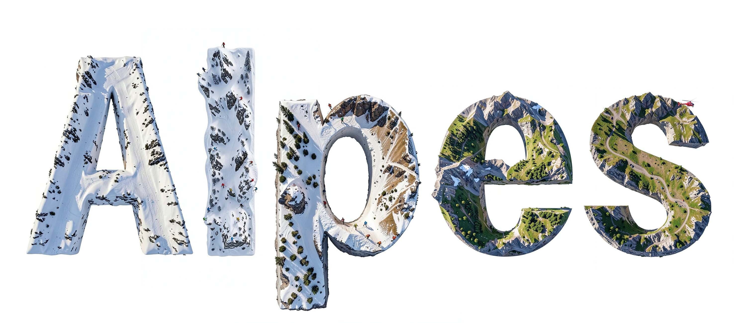
Alpes is a condensed grotesque superfamily offered in sans and mono styles in six weights. The second joint venture between Sharp Type and Image Format, Alpes arose on the bedrock principles of contrasted grotesques, but its final form is an adventurous departure: a pristine, all-terrain typeface sculpted by and for designers that ultimately extends the tradition of its genre forebears into liminal space, opting for distinction without sacrificing readability or quality.