Sharp Earth Mono
The narrower double-story letterforms common in geometrics, along with the distinctly oval bowl shapes found in grotesks, made for an effortless adaptation from the proportional to monospace design. Other features also adapted brilliantly for this purpose, such as the stovepipe curves of the /f and /t, which simply sprawled outward to take up the requisite space required. The specific requirements for this adaptation also provided ample opportunity for experimentation and novelty, such as the “typewriter alternates” stylistic set (ss04), and the sprawling, tucan-beaked /r.
Extrabold Italic, Bold Italic, Medium Italic, Regular Italic, Light Italic, Thin Italic.
ˆ;–°¹’…
`¹ª÷÷÷÷÷÷÷÷÷÷÷÷÷¦ª’`
`¹¯÷÷7%IJ><r™úTZL=zµdÀÆqj´
…wǾ®ZZÿÒÿÚd¤wýáäkOÝär•¡vdÆWz´
¦ÔÕÄØÆÆÆÆÆÆÆÆÆÆá×*¿½e¾s|÷÷CÙ0÷ª…
`;÷÷÷÷÷íâÆÆÆÆÆÆÆÆÆÆÝ[ŸÆÆÆmI!÷÷÷÷÷¦¸
:÷÷÷÷÷÷÷÷¢œBBBBBBÅŠ8ÊÆÆÕ®*4©÷÷÷÷÷÷÷’
…÷÷÷÷÷÷÷÷÷IÆÆÆÆÆÆÆÆÆèõWÂC!!÷÷÷÷÷÷÷÷÷ª
`„÷÷÷÷÷÷÷÷÷÷CÑÆÆÆÆÆÆÆÆÆÜ÷÷÷÷÷÷÷÷÷÷÷÷¡÷›
…¯÷÷÷÷÷÷÷÷÷÷÷«&BÑÑêCò½â÷÷÷÷÷÷÷÷÷÷÷÷÷÷÷¯´
ˆ¦¡|÷÷÷÷÷÷÷÷÷÷¬»¥Æ©÷))}c¡÷÷÷÷÷÷÷÷÷÷÷÷÷¦˜
ˆ¦÷÷÷÷÷÷÷÷÷÷÷÷÷÷÷7bèHÏ«¡¡!¡¡÷÷÷÷÷÷÷÷!¡¦¸
…—÷÷÷÷÷÷÷÷÷÷÷÷÷÷÷÷÷÷÷rI[ŽêO3|÷÷÷÷÷÷÷÷÷^`
`”÷¡÷÷÷÷÷÷÷÷÷÷÷÷÷÷÷÷÷÷÷OÆÑÈ#ÃÃt÷÷÷÷÷÷÷›
·÷÷÷÷÷÷÷÷÷÷÷÷÷÷÷÷÷÷÷÷÷QMBÆÆÆÆÈË4/÷÷÷ª
’÷÷÷÷÷÷÷÷÷÷÷÷÷÷÷÷÷÷÷¡DÃÂQÆÆÆÆÆÆÃl÷÷˜
‘÷÷÷÷÷÷÷÷÷÷÷÷÷÷÷÷÷÷÷/bþÆŒÂÆÆÆÆJ÷¯…
˜¦÷÷÷÷÷÷÷÷÷÷÷÷÷÷÷÷÷÷÷ûËÃÈÆÆÊû¡„·
`¹÷÷÷÷÷÷÷÷÷÷÷÷÷÷÷÷÷¬ÓÆÆÂÃè÷—‘`
`;—÷÷÷÷÷÷÷÷÷÷÷÷÷÷)æÆÆÛ¾ª’
:ª¦÷÷÷÷÷÷÷÷÷÷VÂÀj’`
¨‚:››:˜`
↖↖↖↖↖↖↖↖
↖↖←←←←←←←←←←←←←←←←↖↖
↖↓↗↙←←←←←←←←↙↙↙←←←←←←←←↙↖↖
↖↓→↘↙←←←←←←←←←↙↘→→↘↘↙←↙↓↘↘→→↙↖
↖←←←←←↙←←←←←←→↑↑↙↑↑↑↑↑↑↑↑↑↑↑↑↑↗↖
↖↖←←←←←←←←←↓↘↙←↘↘↓↘↑↑↑↑↑↑↑↑↑↑↑↑↑↑↑←
↖←←←←←←←←←←←↓↑↑↗↑↑↗↑↑↑↑↑↑↑↑↑↑↑↑↑↑↑↑←
↖←←←←←←←←←←←→↑↑↙↙↘↓→↑↙↓↙↙↑↘↓↗↑↑↑↑↑↑↑↗
↖↖←←←←←←←←←←←↙↘↗↗↗↙←←←↙↓→↑↑↑↑↑↑↑↑↑↑↑↑↑↓
↖←←←←←←←←←←←↙↑↑↑↑↑↑↑↑↑↑↗↑↑↑→↗↑↑↑↑↑↑↑↑↑↗↖
↖←←←←←←←←←←→↑↑↑↑↑↑↑↑↑↑↑↑→↗↑↑↗↑↓←↙↑↑↑↑↗↘↖
↖←←←←←←←←←←→↑↑↑↑↑↑↑↑↑↑↑↑↑↓↑↑→←←←←↙↑↑↙←←↖
↖←←←←←←←←←←↙↑↑↑↗↑↑↑↑↑↑↑↑↑↑↗↗↙←←←←←↘↘←←←↖
↖→↘←←←←←←←←←←←←←←↙↑↑↑↑↑↑↑↑↑↓←←←←←←←←←←↖
↖↑↑↘↙←←←←←←←←←←←←↑↑↑↑↑↗↑↘←←←←←←←←←←←←
↙↑↑↑↓←←←←←←←←←←←↓↑↑↑↑↑↑↓←←←←←←←←←←←↖
↖↙↑→←←←←←←←←←←←←→↑↑↑↑↑↑↘←↗←←←←←←←←↖
←←←←←←←←←←←←←←↙↑↑↑↑↑←←↘↘←←←←←←←↖
↖↖←←←←←←←←←←←←→↑↑↑↘←←←←←←←←←↖↖
↖↖←←←←←←←←←←←↘↓←←←←←←←←←↖
↖←←←←←←←←←←←←←←←↖↖↖
↖↖↖↖↖↖↖↖
l
f
In cartography, a map projection is any of a broad set of transformations employed to represent the curved two-dimensional surface of a globe on a plane. In a map projection, coordinates, often expressed as latitude and longitude, of locations from the surface of the globe are transformed to coordinates on a plane.
A third model is the geoid, a more complex and accurate representation of Earth's shape coincident with what mean sea level would be if there were no winds, tides, or land. Compared to the best fitting ellipsoid, a geoidal model would change the characterization of important properties such as distance, conformality and equivalence. Therefore, in geoidal projections that preserve such properties, the mapped graticule would deviate from a mapped ellipsoid's graticule. Normally the geoid is not used as an Earth model for projections, however, because Earth's shape is very regular, with the undulation of the geoid amounting to less than 100 m from the ellipsoidal model out of the 6.3 million m Earth radius. For irregular planetary bodies such as asteroids, however, sometimes models analogous to the geoid are used to project maps from. A third model is the geoid, a more complex and accurate representation of Earth's shape coincident with what mean sea level would be if there were no winds, tides, or land. Compared to the best fitting ellipsoid, a geoidal model would change the characterization of important properties such as distance, conformality and equivalence. Therefore, in geoidal projections that preserve such properties, the mapped graticule would deviate from a mapped ellipsoid's graticule. Normally the geoid is not used as an Earth model for projections, however, because Earth's shape is very regular, with the undulation of the geoid amounting to less than 100 m from the ellipsoidal model out of the 6.3 million m Earth radius. For irregular planetary bodies such as asteroids, however, sometimes models analogous to the geoid are used to project maps from.
Selecting a model for a shape of the Earth involves choosing between the advantages and disadvantages of a sphere versus an ellipsoid. Spherical models are useful for small-scale maps such as world atlases and globes, since the error at that scale is not usually noticeable or important enough to justify using the more complicated ellipsoid. The ellipsoidal model is commonly used to construct topographic maps and for other large- and medium-scale maps that need to accurately depict the land surface. Auxiliary latitudes are often employed in projecting the ellipsoid. Selecting a model for a shape of the Earth involves choosing between the advantages and disadvantages of a sphere versus an ellipsoid. Spherical models are useful for small-scale maps such as world atlases and globes, since the error at that scale is not usually noticeable or important enough to justify using the more complicated ellipsoid. The ellipsoidal model is commonly used to construct topographic maps and for other large- and medium-scale maps that need to accurately depict the land surface. Auxiliary latitudes are often employed in projecting the ellipsoid.
When making a conic map, the map maker arbitrarily picks two standard parallels. Those standard parallels may be visualized as secant lines where the cone intersects the globe—or, if the map maker chooses the same parallel twice, as the tangent line where the cone is tangent to the globe. The resulting conic map has low distortion in scale, shape, and area near those standard parallels. Distances along the parallels to the north of both standard parallels or to the south of both standard parallels are stretched; distances along parallels between the standard parallels are compressed. When a single standard parallel is used, distances along all other parallels are stretched. The projection has the useful property that distances along the meridians are proportionately correct, and distances are also correct along two standard parallels that the mapmaker has chosen. The two standard parallels are also free of distortion. For maps of regions elongated east-to-west (such as the continental United States) the standard parallels are chosen to be about a sixth of the way inside the northern and southern limits of interest. This way distortion is minimized throughout the region of interest.
In the cartography of the United States, the American polyconic projection is a map projection used for maps of the United States and its regions beginning early in the 19th century. It belongs to the polyconic projection class, which consists of map projections whose parallels are non-concentric circular arcs except for the equator, which is straight. Often the American polyconic is simply called the polyconic projection. The American polyconic projection was probably invented by Swiss-American cartographer Ferdinand Rudolph Hassler around 1825. It was commonly used by many map-making agencies of the United States from the time of its proposal until the middle of the 20th century.[1] It is not used much these days, having been replaced by conformal projections in the State Plane Coordinate System. The American polyconic projection can be thought of as "rolling" a cone tangent to the Earth at all parallels of latitude. This generalizes the concept of a conic projection, which uses a single cone to project the globe onto. By using this continuously varying cone, each parallel becomes a circular arc having true scale, contrasting with a conic projection, which can only have one or two parallels at true scale. The scale is also true on the central meridian of the projection.
The first and second coordinates are called the abscissa and the ordinate of P, respectively; and the point where the axes meet is called the origin of the coordinate system. The coordinates are usually written as two numbers in parentheses, in that order, separated by a comma, as in (3, −10.5). Thus the origin has coordinates (0, 0), and the points on the positive half-axes, one unit away from the origin, have coordinates (1, 0) and (0, 1).
In mathematics, physics, and engineering, the first axis is usually defined or depicted as horizontal and oriented to the right, and the second axis is vertical and oriented upwards. (However, in some computer graphics contexts, the ordinate axis may be oriented downwards.) The origin is often labeled O, and the two coordinates are often denoted by the letters X and Y, or x and y. The axes may then be referred to as the X-axis and Y-axis. The choices of letters come from the original convention, which is to use the latter part of the alphabet to indicate unknown values. The first part of the alphabet was used to designate known values.
A Cartesian coordinate system for a three-dimensional space consists of an ordered triplet of lines (the axes) that go through a common point (the origin), and are pair-wise perpendicular; an orientation for each axis; and a single unit of length for all three axes. As in the two-dimensional case, each axis becomes a number line. For any point P of space, one considers a plane through P perpendicular to each coordinate axis, and interprets the point where that plane cuts the axis as a number. The Cartesian coordinates of P are those three numbers, in the chosen order. The reverse construction determines the point P given its three coordinates.
A circle of latitude or line of latitude on Earth is an abstract east–west small circle connecting all locations around Earth (ignoring elevation) at a given latitude coordinate line. Circles of latitude are often called parallels because they are parallel to each other; that is, planes that contain any of these circles never intersect each other. A location's position along a circle of latitude is given by its longitude. Circles of latitude are unlike circles of longitude, which are all great circles with the centre of Earth in the middle, as the circles of latitude get smaller as the distance from the Equator increases. Their length can be calculated by a common sine or cosine function. For example, the 60th parallel north or south is half as long as the Equator (disregarding Earth's minor flattening by 0.335%), stemming from cos(60∘)=0.5 {\displaystyle \cos(60^{\circ })=0.5}. On the Mercator projection or on the Gall-Peters projection, a circle of latitude is perpendicular to all meridians.[1] On the ellipsoid or on spherical projection, all circles of latitude are rhumb lines, except the Equator. Arcs of circles of latitude are sometimes used as boundaries between countries or regions where distinctive natural borders are lacking (such as in deserts), or when an artificial border is drawn as a "line on a map", which was made in massive scale during the 1884 Berlin Conference, regarding huge parts of the African continent. North American nations and states have also mostly been created by straight lines, which are often parts of circles of latitudes. For instance, the northern border of Colorado is at 41° N while the southern border is at 37° N. Roughly half the length of the border between the United States and Canada follows 49° N.
The latitude of the circle is approximately the angle between the Equator and the circle, with the angle's vertex at Earth's centre. The Equator is at 0°, and the North Pole and South Pole are at 90° north and 90° south, respectively. The Equator is the longest circle of latitude and is the only circle of latitude which also is a great circle. As such, it is perpendicular to all meridians. There are 89 integral (whole degree) circles of latitude between the Equator and the poles in each hemisphere, but these can be divided into more precise measurements of latitude, and are often represented as a decimal degree (e.g. 34.637° N) or with minutes and seconds (e.g. 22°14′26″ S). On a map, the circles of latitude may or may not be parallel, and their spacing may vary, depending on which projection is used to map the surface of the Earth onto a plane. On an equirectangular projection, centered on the equator, the circles of latitude are horizontal, parallel, and equally spaced. On other cylindrical and pseudocylindrical projections, the circles of latitude are horizontal and parallel, but may be spaced unevenly to give the map useful characteristics. For instance, on a Mercator projection the circles of latitude are more widely spaced near the poles to preserve local scales and shapes, while on a Gall–Peters projection the circles of latitude are spaced more closely near the poles so that comparisons of area will be accurate. On most non-cylindrical and non-pseudocylindrical projections, the circles of latitude are neither straight nor parallel.
There are five major circles of latitude, listed below from north to south. The position of the Equator is fixed (90 degrees from Earth's axis of rotation) but the latitudes of the other circles depend on the tilt of this axis relative to the plane of Earth's orbit, and so are not perfectly fixed. The values below are for 25 November 2025
The Arctic Circle is one of the two polar circles, and the northernmost of the five major circles of latitude as shown on maps of Earth at about 66° 34' N. Its southern counterpart is the Antarctic Circle. The Arctic Circle marks the southernmost latitude for which, at the winter solstice in the Northern Hemisphere (in December), the Sun does not rise at all. Likewise the Antarctic Circle marks the northernmost latitude for which, at the summer solstice in the Southern Hemisphere (also in December), the Sun does not set. These phenomena are referred to as polar night and midnight sun respectively, and the closer to the respective pole one goes, the longer that situation persists. For example, in the Russian port city of Murmansk (three degrees north of the Arctic Circle) the Sun stays below the horizon for 20 days before and after the winter solstice, and above the horizon for 20 days before and after the summer solstice.
The positions of the Arctic and Antarctic Circles vary slightly from year to year. Currently the Arctic Circle is 66°33′50.7″ north of the Equator. Its latitude depends on Earth's axial tilt, which fluctuates by a margin of some 2° over a 41,000-year period due to tidal forces resulting from the orbit of the Moon. Consequently, in the current epoch the Arctic Circle is drifting toward the North Pole, while the Antarctic Circle drifts towards the South Pole, each at a speed of about 14.5 m (48 ft) per year.
The largest communities north of the Arctic Circle are situated in Russia, Norway, and Sweden: Murmansk (population 295,374) and Norilsk (178,018) in Russia; Tromsø (75,638) in Norway, Vorkuta (58,133) in Russia, Bodø (52,357) and Harstad (24,703) in Norway; and Kiruna, Sweden (22,841). In Finland, the largest settlement in the immediate vicinity of the Arctic Circle is Rovaniemi (62,667), lying 6 km (4 mi) south of the line. Salekhard (51,186) in Russia is the only city in the world located directly on the Arctic Circle.[10] In contrast, the largest North American community north of the Arctic Circle, Sisimiut (Greenland), has approximately 5,600 inhabitants. In the United States, Utqiagvik, Alaska (formerly known as Barrow) is the largest settlement north of the Arctic Circle with about 5,000 inhabitants. The largest such community in Canada is Inuvik in the Northwest Territories, with 3,137 inhabitants. The Arctic Circle is roughly 16,000 km (9,900 mi) in circumference.[11] The area north of the Circle is about 20,000,000 km2 (7,700,000 sq mi) and covers roughly 4% of Earth's surface.[12] The Arctic Circle passes through the Arctic Ocean, the Scandinavian Peninsula, North Asia, Northern America, and Greenland. The land within the Arctic Circle is divided among eight countries: Norway, Sweden, Finland, Russia, the United States (Alaska), Canada (Yukon, Northwest Territories, and Nunavut), Denmark (Greenland), and Iceland (where it passes through the small offshore island of Grímsey).
The Arctic Circle is the southernmost latitude in the Northern Hemisphere at which the centre of the Sun can remain continuously above or below the horizon for twenty-four hours; as a result, at least once each year at any location within the Arctic Circle the centre of the Sun is visible at local midnight, and at least once the centre is not visible at local noon. Directly on the Arctic Circle these events occur, in principle, exactly once per year: at the June and December solstices, respectively. However, because of atmospheric refraction and mirages, and also because the sun appears as a disk and not a point, part of the midnight sun is visible, on the night of the northern summer solstice, at a latitude of about 50 minutes of arc (′) (90 km (56 mi)) south of the Arctic Circle. Similarly, on the day of the northern winter solstice, part of the Sun may be seen up to about 50′ north of the Arctic Circle. That is true at sea level; those limits increase with elevation above sea level, although in mountainous regions there is often no direct view of the true horizon.The positions of the Arctic and Antarctic Circles vary slightly from year to year. Currently the Arctic Circle is 66°33′50.7″ north of the Equator. Its latitude depends on Earth's axial tilt, which fluctuates by a margin of some 2° over a 41,000-year period due to tidal forces resulting from the orbit of the Moon. Consequently, in the current epoch the Arctic Circle is drifting toward the North Pole, while the Antarctic Circle drifts towards the South Pole, each at a speed of about 14.5 m (48 ft) per year.
Whalers who sailed far north in the 17th and 18th centuries used the islands as a base; subsequently, the archipelago was abandoned. Coal mining started at the beginning of the 20th century, and several permanent communities such as Pyramiden and Barentsburg were established. The Svalbard Treaty of 1920 recognizes Norwegian sovereignty, and the Norwegian Svalbard Act
A Norwegian archipelago that lies at the convergence of the Arctic Ocean with the Atlantic Ocean. North of mainland Europe, it lies about midway between the northern coast of Norway and the North Pole. The islands of the group range from 74° to 81° north latitude, and from 10° to 35° east longitude. The largest island is Spitsbergen (37,673 km2), followed in size by Nordaustlandet (14,443 km2), Edgeøya (5,073 km2), and Barentsøya (1,288 km2). Bjørnøya or Bear Island (178 km2) is the most southerly island in the territory, situated some 147 km south of Spitsbergen. Other small islands in the group include Hopen to the southeast of Edgeøya, Kongsøya and Svenskøya in the east, and Kvitøya to the northeast. The largest settlement is Longyearbyen, situated in Isfjorden on the west coast of Spitsbergen.
Research and tourism have become important supplementary industries, with the University Centre in Svalbard and the Svalbard Global Seed Vault playing critical roles in the local economy. Apart from Longyearbyen, other settlements include the Russian mining community of Barentsburg, the Norwegian research station of Ny-Ålesund, the Polish research station of Hornsund, the settlement of Nybyen, and the Swedish-Norwegian mining outpost of Sveagruva (which closed in 2020).[9] Other settlements lie farther north, but are populated only by rotating groups of researchers. No roads connect the settlements; instead, snowmobiles, aircraft, and boats provide inter-settlement transport. Svalbard Airport serves as the main gateway. Whalers who sailed far north in the 17th and 18th centuries used the islands as a base; subsequently, the archipelago was abandoned.[6][7] Coal mining started at the beginning of the 20th century, and several permanent communities such as Pyramiden and Barentsburg were established. The Svalbard Treaty of 1920 recognizes Norwegian sovereignty, and the Norwegian Svalbard Act of 1925 made Svalbard a full part of the Kingdom of Norway. The Svalbard Treaty established Svalbard as a free economic zone and restricts the military use of the archipelago. The Norwegian Store Norske and the Russian Arktikugol remain the only mining companies in place.
Research and tourism have become important supplementary industries, with the University Centre in Svalbard and the Svalbard Global Seed Vault playing critical roles in the local economy. Apart from Longyearbyen, other settlements include the Russian mining community of Barentsburg, the Norwegian research station of Ny-Ålesund, the Polish research station of Hornsund, the settlement of Nybyen, and the Swedish-Norwegian mining outpost of Sveagruva (which closed in 2020). Other settlements lie farther north, but are populated only by rotating groups of researchers. No roads connect the settlements; instead, snowmobiles, aircraft, and boats provide inter-settlement transport. Svalbard Airport serves as the main gateway Approximately 60% of the archipelago is covered with glaciers, and the islands feature many mountains and fjords. The archipelago has an Arctic climate, although with significantly higher temperatures than other areas at the same latitude due to the impact of the tail end of the Gulf Stream from the Atlantic Ocean. The flora has adapted to take advantage of the long period of midnight sun to compensate for the polar night. Many seabirds use Svalbard as a breeding ground, and it is home to polar bears, reindeer, the Arctic fox, and certain marine mammals. Seven national parks and 23 nature reserves cover two-thirds of the archipelago, protecting the largely untouched fragile environment. Norway announced new regulations regarding tourism in February 2024, including a maximum of 200 people on a ship, to protect flora and fauna in Svalbard.
The climate north of the Arctic Circle is generally cold, but the coastal areas of Norway have a generally mild climate as a result of the Gulf Stream, which makes the ports of northern Norway and northwest Russia ice-free all year long. In the interior, summers can be quite warm, while winters are extremely cold. For example, summer temperatures in Norilsk, Russia will sometimes reach as high as 30 °C (86 °F), while the winter temperatures frequently fall below −50 °C (−58 °F). Midnight sun, also known as polar day, is a natural phenomenon that occurs in the summer months in places north of the Arctic Circle or south of the Antarctic Circle, when the Sun remains visible at the local midnight. When midnight sun is seen in the Arctic, the Sun appears to move from left to right. In Antarctica, the equivalent apparent motion is from right to left. This occurs at latitudes ranging from approximately 65°44' to exactly 90° north or south, and does not stop exactly at the Arctic Circle or the Antarctic Circle, due to refraction. Because there are no permanent human settlements south of the Antarctic Circle, apart from research stations, the countries and territories whose populations experience midnight sun are limited to those crossed by the Arctic Circle: Canada (Yukon, Nunavut, and Northwest Territories), Finland, Greenland, Iceland, Norway, Russia, Sweden, and the United States (state of Alaska).
’’’’’’’’’’’’’’’’’’’’’’’’’’’’’’’’’’’’’’’’’’’’’’’’’’’’’’’’’’’’’’’’’’’’’’’’’’’’’’’’’’’’’’’’’’’’’’’’’’’’’’’’’’’’’’’’’’’’’’’’’’’’’’’’’’’’’’’’’’’’’’’’’’’’’’’’’’’’’’’’’’’’’’’’’’’’’’’’’’’’’’’’’’’’’’’’’’’’’’’’’’’’’’
’’’’’’’’’’’’’’’’’’’’’’’’’’’’’’’’’’’’’’’’’’’’’’’:¹“÷?}=ií1[†}³¹›ª«—º—(•|>ïIóLòcvr1|•‹::’’’’’’’’’’’’’’’’’’’’’’’’’’’’’’’’’’’’’’’:’’’’’’’’’’’’’’’’’’’’’’’’’’’’’’’’’’’’’’’’’’’’’’’’’’’’’’’’’’’’’’’’’’’’’’’’’’’’’
’’’’’’’’’’’’’’’’’’’’’’’’’’’’’:²’~÷¹’²}i+“(7¢ÝÓç¼®ŸãÔ&‰){l@&ÄÆÆÆÆÆÆÆÆÆÆÆÆÆÆÆÆÆÆÆÆÆÆÆÙ×’’’’’’’’’’’’’’’«Y©hU¿>L>¹;’’’’’’’’’’’;’’’::’’’’’’’’’:’’’’’’’²÷Yù‰7‰i‹’’’’’’’’’’’’’’’’’’’’’’’’’’’’’’’’’’’’’’’’’’’’’’’’’’
’’’’’’’’’’’’’’’’’’’’’’’’’’:(¿^”/ìCözs«”;«<¦™*µOÇUšás;’’’’:¹°³ùÈÆÆÆÆÆÆÆÆÆÆÆÆÆÆÆÆÆä÷’’’’’’’’’’’’’’’’’’’’’’’’’’’’’’’’’’’’’’’’îÙõ•¹‹;’’’’’:;;›!šœWÃÃÃÈØÆƌ؊š{’’’’’’’’’’’›—wÍ<<²í?’’’’’’’’’’’’’’’’’’’’’’’’’
’’’’’›¯<LùCl{)”›¹’’’’’’::²!¢ò»jšÚpKÁŽHj»<JoÚó;%ZµHN€ZœF4<«¹’’’’’’¯@&ËÆÆÆÆÆÆÆÆÆÆÆÿÝV5–’’’’’’:’’’’’’’’’’’’’’’;²¡ì++¹’’’’’’’’’’’×û’’’×ßÆPúTTÕßØÆÆÆÆÆÆÆÆÆÆÆÆÆÆÆÆÆÆÆÆÆÆÆÆ#ùCû§U9gWX$ßDVj¢óc¹’’’’’:’’’–?¬’’’’’’’’
’’’„çýŽÊÆÆÆÆÆÆÆÆÆÁÆÆÆÉÆÆÆÆÆÆÆÆÆÆñw™@ùÞxÍ0ü2üNØq¼yþಋ173KÀbL=“’’’’¡ƒêÆÆÆÆÆÆËÃ$Jì^:’:’’’;’’’’’’’’’’’’’’’¹ìôðHHøÊŒÛÑEþÃmç—/¾/0ÿßbKËpÆÆÆŒãHZYÉøÑÆÆÆÆÆÆÆÆÆÆÆÆÆÆÆÆÆÆÆÆÆÆÆÆÆÆÆÆÆÆÆÆÆÆÆÆÆÆÆÆÆÆÆÆÆÆÆÆÆŒØÆÆÆÆŒëü¦•²’’’’
’’’³††‡ÆÆÆÆÆÆÆÆÆÆþÆÆÆÆÆÆÆÆÆÆÆÆÆÆÆÆÆÆÆÆÆÆÆÆÆÊEÅ⼟Ôü“—™[ü#ØQû“’’’’’:קÆÆÆŒÍ:’’’’’’’’kæg®~’’’’’’’’’’’;º©pËÆM€¡uBÆB#ÆœÏÞðŒÆÆÆÆÆÆÆÆÆÆÆÆÆÆÆÆÆÆÆÆÆÆÆÆÆÆÆÆÆÆÆÆÆÆÆÆÆÆÆÆÆÆÆÆÆÆÆÆÆÆÆÆÆÆÆÆÆÆÆÆÆÆÆÆÆÆÆÑÆÆÆÆÆÆ$s¹’:¿»;’’’’
’’’„£¶ËÆÆÆÊbbŸ‰ñþqþMÆÆÆÆÆÆÆÆÆÆÆÆÆÆÆÆÆÆÆÆÆÆÆߦ’’’’::–÷ã#Ešï~º:’’’’’’’¹í¼®{’’’’’’’’’’’’’’’’’’’’’’›’’:LÕÆBBÆg¡’PÅÕå€ÈÆÆÆÆÆÆÆÆÆÆÆÆÆÆÆÆÆÆÆÆÆÆÆÆÆÆÆÆÆÆÆÆÆÆÆÆÆÆÆÆÆÆÆÆÆÆÆÆÆÆÆÆÆÆÆÆÆÆÆÆÆÆÆÆÆÆÆÆø7/̉ÜXGéši÷;’’’’’’’’’’’
’’’’’’›“Íújª’’’’’’’–»IýMÆÆÆÆÆÆÆÆÆÆÆÆÆÆÆÆÆÆÆÂ4/^’’’’’„ÇÆÆÆÁZŽØw›’’’’’’’’’’’’’’’’’’’’’’’’’’’’’~Va‹’’’”%*(œÆ2|:3sÀKÊÆÆÆÆÆÆÆÆÆÆÆÆÆÆÆÆÆÆÆÆÆÆÆÆÆÆÆÆÆÆÆÆÆÆÆÆÆÆÆÆÆÆÆÆÆÆÆÆÆÆÆÆÆÆÆÆÆÆÆÆßö¹’’’’’’’íbÑû–’’’’’’’’’’’’’’’’’’
’’’;¦¦;;’’’’’’’’’’’’’:!×êÆÆÆÆÆÆÆÆÆÆÆÆÆÆÆÆÆÆÆÆÆÆÆBg±›xØÆÆÆÆÆÆÆÆéͯ’’’’’’’’’’’’’’’’’’’’’’’’’;%Ù¬áý~’’¹º£<[„v±såÁëŒÆÕÉÆÆÆÆÆÆÆÆÆÆÆÆÆÆÑWNH€gXRÂNÃÆÆÆÆÆÆÆÆÆÆÆÆÆÆÆÆÄKÆÆÆÆÆÑÊÊÆÆÆÆÆÇ+«²’’’’’’†ÆØÓ7’;‹’’’’’’’’’’’’’’’’
’’’’’’’’’’’’’’’’’’’’’’’:2NÆÆÆÆÆÆÆÆÆÆÆÆÆÆÆÆÆÆÆÆÆÆÆQVûÆÆÆÆÆÆÆÆÆÆœž„’’’’’’’’’’’’’’’’’’’’’’’’‹i|”úÁ®¬ÌŸËÆÆÉýMÆÆÆXMRéêÉéØÆÆÆÆÆÆBømXÅæK€ÆÆÆÆÆÆÆÆÊÔX#ÊÆÆÆWØÆÀÂqQŠNŒÆÆÆÆÆÅÀÆÆÁÊÆÆÆÆÆÆF&”’’’’’:¾¡’’’’’’’’’’::’:’’’’’’’
’’’’’’’’’’’’’’’’’’’’’’’’’:[4$BBBBBBBBBBBBBBÀÂAeuSÉÆÆÆÆÆÆØÙÞ4)¦:rÔÓc:’’’’’’’’’’’’’’’’’’’’’’’’’”0ÜÃÆÆÃpEBpÂßG€ëqŽAEÆÆÆÆÃqÆÆÆšËÆÆÆÆÆÆÆÆÆÆÆÆÆÆÆÆÆÆÆWêêQÆÆÆÆÆÆÆÆÆÈÄBÆÛêNÆÆÆÆÆKQêÃÆÛ¦†°’’’’’’’’’’’’’’’’’’’’’’’’’’’’’
’’’’’’’’’’’’’’’’’’’’’’’’’’’àÆÆÆÆÆÆÆÆÆÆÆÆÆÆÆÆÆÆÆèjò^ôÆMBQæH8Ó6î(’’’’’’’’’’’’’’’’’’’’’’’’’’’’’’’’»ŒÆÆŒÖÂË0õpÙmÀÊÆÁU;¬ð„8ÆÆÆÆSª~eŒæÚ%ÁÆÆÆÆÆÆÆÆÆÑþÃÆÆÆKWWÑÆÆÆÆÆÆÆÆNBKËÆÆÆÆÆÆÑBÄȵ¹;(¹:›;:’’’’’’’’’’’’’’’’’’’’’’’’’
’’’’’’’’’’’’’’’’’’’’’’’’’’–QÆÆÆÆÆÆÆÆÆÆÆÆÆÆÆÆÆÆÆIšËö‡mËÆÆþ°’:’’’’’’’’’’’’’’’’’’’’’’’’’’’’’’’CEÉÈÈKÞ„²¹¿cBi–!ZäËØD›’~÷:’¹FÃ㜲’nÔâ¥$ŒÊÅÈÑ8ÀÁÆÆÓQÆÆÆÆÆÆÆÊþGâÄQŠéXÊÆÆÆÆÆÆÆØBU„³›’:on¦;’’’’’’’’’’’’’’’’’’’’’’’’’’’’
’’’’’’’’’’’’’’’’’’’’’’’’’’’fÆÆÆÆÆÆÆÆÆÆÆÆÆÆÆÆÆÆÆÆÆÆÆÆÆ⟔’’’’’’’’’’’’’’’’’’’’’’’’’’’’’’’’’’’hÁÆÆËj’›’“<’’²c÷IÁ¬°8ÉÆÆÆÆÆÆÆBáãú›!ÀÆÆÆØæÁŒA88Õ#ÆÆÆÆÆÆÆÆÆÆÆÆÆÆÆÆÆÆÆÆÆÆR3^j휩;’’’’;qì’’’’’’’’’’’’’’’’’’’’’’’’’’’’’’
’’’’’’’’’’’’’’’’’’’’’’’’’’’:çÆÆÆÆÆÆÆÆÆÆÆÆÆÆÆÆÆÆÆÆÆÆÆÆÖ:’’’’’’’’’’’’’’’’’’’’’’’’’’’’’’’’’’’’;|šÌ„sôáäPŽ+’7’’’(¹“Y%9sUÔÛGÉÐÑÆÓ6NÆÆNþKBÆÅÑÖøø#ÆÆÆÆÆÆÆÆÆÆÆÆÆÆÆÆÆÆÆÆÆÆÅ2”’I˃’~^§N¾’’’’’’’’’’’’’’’’’’’’’’’’’’’’’’’
’’’’’’’’’’’’’’’’’’’’’’’’’’’’’’JWŒÆÆÆÆÆÆÆÆÆÆÆÆÆÆÆÆÆÆÃv’’’’’’’’’’’’’’’’’’’’’’’’’’’’’’’’’’’’’’¿ÀÆÆÙÆÆÆÆWÑsª’’‹„›’’’’’’ýQpÆÆÛÉÆÆÆÆÆÆÂÀÆÆÆÉQÆEÆÑXÆÆÆÆÆÆÆÆÆÆÆÆÆÆÆÆÆÆÆÆÆÆu’’¹’ïlõ†:’’’’’’’’’’’’’’’’’’’’’’’’’’’’’’’’’
’’’’’’’’’’’’’’’’’’’’’’’’’’’’’’’ixOBBÊæÆØÆÆÆÉB¾½¾ÔÀ{’’’’’’’’’’’’’’’’’’’’’’’’’’’’’’’’’’’’’’›ØÉÛŒÆÆÆÆÆÆÒÆÆÊÛÒ$ÆQNgâÀãñÀÄÆÂ8ÆR§WÆÆÆÆŒÀØÃþØÆÊEÆÆÁ¥BÆÆÆÆÆÆÑÆÆÆÆÆÆÆÆÆÆÆÆÆ9~’’’‹‹’’’’’’’’’’’’’’’’’’’’’’’’’’’’’’’’’’’’
’’’’’’’’’’’’’’’’’’’’’’’’’’’’’’’’?aíœÆÆÆÆRg{’’’’’’’wú::’’’’’’’’’’’’’’’’’’’’’’’’’’’’’’’’›ºªåMŽÉÆÆÆÆÆÆÆÆpÆÆÆÆÆÆÆÉØÆÆÆê¡ðÆÆÆÆÆÆU‹4ÄÙWÆÊ€ÆÆÂXHÆÆÆÆNÉÛdÇšñÈHðÂÆÆÆÆÆÆÆÆÆÆÃc’’’::’’’’’’’’’’’’’’’’’’’’’’’’’’’’’’’’’’’’’
’’’’’’’’’’’’’’’’’’’’’’’’’’’’’’’’’–&²SØÆÆÆÔ¦’’’’’’’:’²º;’’’’’’’’’’’’’’’’’’’’’’’’’’’’’’’’*ÆQÆÆÜÕÀÆÆÆÆÆÆØŠÉÆŒÆÆÆËØÆÆÆƺýÆÆÆÆÆÆ¥*ƒõ•’:’’ìHXÊÆÆÆÆÆÆÆÆmW8ÛÊWËÆÆÆÆÆÆÆÆÆp(¤«’:’’’’’’’’’’’’’’’’’’’’’’’’’’’’’’’’’’’’’’’
’’’’’’’:°:’’’’’’’’’’’’’’’’’’’’’’’’’’’öÆÆÆê|’’:cõ›~¯÷¤‰:;’’’’’’’’’’’’’’’’’’’’’’’’’’’’’’¡ÿ8þÆÆQÆÆÑÕÆÆÆHBÑÆÉØËœMÉØÆÆÆÊÉÙ²ŽÆÆÆÆÆÆÆÈgÆ}’’’’–måBÆÆÆÆÆÆð(~IÂÆÆMTÜËæiÌ}³:’’–’’’’’’’’’’’’’’’’’’’’’’’’’’’’’’’’’’’’’’’’’’
’’’’’’’’’³¹’’’’’’’’’’’’’’’’’’’’’’’’’’3AÆÆR54PŽ<’’’’º«:?Uc¹ì’’’’’’’’’’’’’’’’’’’’’’’’’’›DÆÆÆÆÑæÆÆÆÑGÅÆÆÆÆØæÆÆÆÆÆÆÆÆÆÆÈÌ;ñÆÆÑEÆÛØÜ•’’’’’’’+ÄÆÆÆÆÉo’’’’JÆQÊêø$ì³t’’’’’o»’’’’’’’’’’’’’’’’’’’’’’’’’’’’’’’’’’’’’’’’’
’’’’’’’’’’’’’’’’’’’’’’’’’’’’’’’’’’’’’’’’’“Ï^SøÜÌV=’’’’’’’’’’’’’’’’’’’’’’’’’’’’’’’’’›’’—ßÃ#ʌƀÆÂBÆÊÆÆÆÆŒmÆÆÆÊgÆÆÆÆÆÆBæj‹ÁÆƶv’’’’’’’’’’›áÆÆMv’’’’’’‹„t#ÆÆÃAk¹’’’’:Z¡’’’’’’’’’’’’’’’’’’’’’’’’’’’’’’’’’’’’’’’’’
’’’’’’’’’’’’’’’’’’’’’’’’’’’’’’’’’’’’’’’’’’’’’’’*Æb’’’’’’›’’’’’’’’’’’’’’’’’’’’’’’’’’’’’¹jT9MgÆæÁÆØ9#ÆÆÀÆÆTÆÆÆbÆÆÆÆÆÆÆmÆÆm[°’’’^’’’’’’’’’’‹ËƲ’’’’’:›’‹Ÿ7âÆMq»’’’’’!¡«’’’’’’’’’’’’’’’’’’’’’’’’’’’’’’’’’’’’’’’
’’’’’’’’’’’’’’’’’’’’’’’’’’’’’’’’’’’’’’’’’’’’’’’’¡ô<¡½~RÔ¼ÆKÛmÙc’’’’’’’’’’’’’’’’’’’’’’’’’cœ#ÕGÄãÆÐØÄÆÆÆÆXœÑÆŠBëqNRŒBqÆÆÆÆœ#ÆÆú’’’’’’’’’’’’’«Qî!’’’’’’’’³‡:’ij:’’’’°„’*~«’’’’’’’’’’’’’’’’’’’’’’’’’’’’’’’’’’’’’’’
’’’’’’’’’’’’’’’’’’’’’’’’’’’’’’’’’’’’’’’’’’’’’’’’’’’‹”øÆŒAgNÆÆÊŠN>„›’’’’’’’’’’’’’’’’’’’’’’/åêÉÆŠÆøÝáØÆQÔÉgÊÆÆÆÆŠBÆÆÆãÆÆÆÆÆQAû›’’’’’’’’’’’’’’’„a›’’’’’:’’“ö³’’’’’’;c¹›°ü1:’’’’’’’’’’’’’’’’’’’’’’’’’’’’’’’’’’’’’’
’’’’’’’’’’’’’’’’’’’’’’’’’’’’’’’’’’’’’’’’’’’’’’’’’’’’¹bÆÆÆÆêÊFšBØXØŠ§’’’’’’’’’’’’’’’’’’’’’’’’’’’’’’’’;lÆÆMgÇÑØÆÆÆØûÿ8ØèpâÆÆñ’’’’’’’’’’’’’’’’’’’’’’’’’’›Ür±8’’–’°üâš¹’’’;’’’’’’’’’’’’’’’’’’’’’’’’’’’’’’’’’’’’’’’
’’’’’’’’’’’’’’’’’’’’’’’’’’’’’’’’’’’’’’’’’’’’’’’’’’’»ßmÆÆÆÔæÁ#ÆÑNÂÆÆŒ¿’’’’’’’’’’’’’’’’’’’’’’’’’’’’’’’’vËæEØXÆÆÆÆÆÅæêêÆÆQÂβ’’’’’’’’’’’’’’’’’’’’’’’’’’’’›àWw’ªÜÅNŒ¶ªl‡l;c›’’’’’’’’’’’’’’’’’’’’’’’’’’’’’’’’’’’’’
’’’’’’’’’’’’’’’’’’’’’’’’’’’’’’’’’’’’’’’’’’’’’’’’’’:ÍØÄÂ#MÛÑÆÆÆÆÆÆÆÈþýÄW2¢|‹’’’’’’’’’’’’’’’’’’’’’’’’’’rÉÂXÅÆÆÆÆÆÆ8ZãWŽØê»’’’’’’’’’’’’’’’’’’’’’’’’’’’’’’’¹ÏŒè?¦nHØM^&俲‹¦!}軵Ÿu³’:’:›’’’’’’’’’’’’’’’’’’’’’’’’’
’’’’’’’’’’’’’’’’’’’’’’’’’’’’’’’’’’’’’’’’’’’’’’’’’’ºèêÆÆHÈÑÆÆÆÆÆÆÆÆÆÆÆÆÆÆÆÆÆÚ†’’’’’’’’’’’’’’’’’’’’’’’’’“à¶MÆÆÆÆÆÆøÆÆÆÆʳ’’’’’’’’’’’’’’’’’’’’’’’’’’’’’’’’’’²ÿï›’’’’’×)÷’’’’’;îÁêØÆü²“1’’’’’’’’’’’’’’’’’’’’’’’
’’’’’’’’’’’’’’’’’’’’’’’’’’’’’’’’’’’’’’’’’’’’’’’’’’’›ñÆÑ#ÆÆÆÆÆÆÆÆÆÆÆÆÆÆÆÆÆÆÆÆ€’’’’’’’’’’’’’’’’’’’’’’’’’’%ÆÈÀBâÆÆÆAûÆÆÆÆ÷’’’’’’’’’’’’’’’’’’’’’’’’’’’’’’’’’’’’³/>&Ï[(¯í~„”¹:›’’º1ÒÜ{ÍO’’’’º–’’’’’’’’’’’’’’’’’’’’
’’’’’’’’’’’’’’’’’’’’’’’’’’’’’’’’’’’’’’’’’’’’’’’’’’’’ªâÆÆÈœq#BÆÆÆÆÆÆÆÆÆÆÆÆÆÆÇ–’’’’’’’’’’’’’’’’’’’’’’’’’’°ÆÆÆÆÄWêßÅÆÛàŠÁD‹¹’’’’’’’’’’’’’’’’’’’’’’’’’’’’’’’’’’’’’’’’’’¹;°’’~”÷::’’|;’¹³‹;’’’›’:’’’’’’’’’’’’’’’’’
’’’’’’’’’’’’’’’’’’’’’’’’’’’’’’’’’’’’’’’’’’’’’’’’’’’’’»WÆÆEÃÆÆØœÆÆÆÆÆÆÆÆÆÆÆÍ’’’’’’’’’’’’’’’’’’’’’’’’’’’¹ýÆÆÆÆéÑÆÆËÅÀÝNÆÚ²’’³m¦’’’’’’’’’’’’’’’’’’’’’’’’’’’’’’’’’’’’’’’’;r×ÏÊÆA;’°ø@–’’’’’’’’’’:;’’’’’’’’’’¡›’’’’
’’’’’’’’’’’’’’’’’’’’’’’’’’’’’’’’’’’’’’’’’’’’’’’’’’’’’’’“øÁØÆÆÆÆÁÈÆÆÆÆÆÆÆÆÆv’’’’’’’’’’’’’’’’’’’’’’’’’’’/åÕÔqÆWÁÑÂÉÆÄ#Œš³’«þÆd¹’’’’’’’’’’’’’’’’’’’’’’’’’’’’’’’’’’’’’’;%€ÆÆÆÆÆÆŒO”QÆ6:’’’’’’’’’’’’’’’’‹’’’’’’’’’
’’’’’’’’’’’’’’’’’’’’’’’’’’’’’’’’’’’’’’’’’’’’’’’’’’’’’’’’’hMÆÆBÁÀÀÆÆÆÆÆÆÆÆ$º’’’’’’’’’’’’’’’’’’’’’’’’’’’’çÆÆÆ#ØÆÂÀÆÆÂÙ–’’’¬KÆ2’’’’:’’’’’’’’’’’’’’’’’’’’’’’’’’’’’’’’”YÿMÆÆÆÆÆÆÆÆÆÆÆÆÈÿ“’’’’’’’”;’:’’’’’’’’’’’’’’’
’’’’’’’’’’’’’’’’’’’’’’’’’’’’’’’’’’’’’’’’’’’’’’’’’’’’’’’’’ð¶#œÀBÆ#ÕŒÆÆÆŽŸY°’’’’’’’’’’’’’’’’’’’’’’’’’’’’’’®ÆÆÅÆÆÆÀÁWÉÆ–’’’@ÆB–’’’’’’’’’’’’’’’’’’’’’’’’’’’’’’’’’’’öØÆÆÆÆÆÆÆÆÆÆÆÆÆÆÆÆÆÆœ>’’’’’’’:;’’’’’’’’’’’’’’’’
’’’’’’’’’’’’’’’’’’’’’’’’’’’’’’’’’’’’’’’’’’’’’’’’’’’’’’’’þØÆÆÆÆŒXÅgÆQï’’’’’’’’’’’’’’’’’’’’’’’’’’’’’’’’’’)ÆÆÔÁHÁÆÆX¤’’’’’’³’’’’’’’’’’’’’’’’’’’’’’’’’’’’’’’’’’’’’ƒÈÆÆÆÆÆÆÆÆÆÆÆÆÆÆÆÆÆÆÆÆô’’’’’’’’’’’’’’’’’’’’’’’’
’’’’’’’’’’’’’’’’’’’’’’’’’’’’’’’’’’’’’’’’’’’’’’’’’’’’’’’’±ÄÆÆÆÆÆÆþWÆÆë~’’’’’’’’’’’’’’’’’’’’’’’’’’’’’’’’’’;VÅWÆÆÆÁRþ¬’’’’’’’’’’’’’’’’’’’’’’’’’’’’’’’’’’’’’’’’’’’’”œÆÆÆÆÆÆÆÆÆÆÆÆÆÆÆÆÆÆÆƶ›’’’’’’’’’’’’’’’’’’’’’’’
’’’’’’’’’’’’’’’’’’’’’’’’’’’’’’’’’’’’’’’’’’’’’’’’’’’’’’’’eÐÆÆÆÆÆØÀNR<’’’’’’’’’’’’’’’’’’’’’’’’’’’’’’’’’’’’’’ñÆÆÆÆÈ&’’’’’’’’’’’’’’’’’’’’’’’’’’’’’’’’’’’’’’’’’’’’’’’nÆÆÆÆŒý®Ï±PÂÑŒÆÆÆÆÆÆØv’’’’’’’’’’’’’’’’’’’’’’’’
’’’’’’’’’’’’’’’’’’’’’’’’’’’’’’’’’’’’’’’’’’’’’’’’’’’’’’’„BÔÆÆÆÆÆ£ô¬’’’’’’’’’’’’’’’’’’’’’’’’’’’’’’’’’’’’’’’;í”;’’’’’’’’’’’’’’’’’’’’’’’’’’’’’’’’’’’’’’’’’’’’’’’’’’+P%’’’’’’’’(!ÝÆÆÆÆÆWl’’’’’’’’’’’²º’’’’’’’’’’’’
’’’’’’’’’’’’’’’’’’’’’’’’’’’’’’’’’’’’’’’’’’’’’’’’’’’’’’;®êÆÆÆÆÆÆÆs’’’’’’’’’’’’’’’’’’’’’’’’’’’’’’’’’’’’’’’’’’’’’’’’’’’’’’’’’’’’’’’’’’’’’’’’’’’’’’’’’’’’’’’’’’’’’’’’’’’’’’’’’’’’’0NÛKhc;’’’’’’’’’’’’̾I’’’’’’’’’’
’’’’’’’’’’’’’’’’’’’’’’’’’’’’’’’’’’’’’’’’’’’’’’’’’’’’’’‹9ãÆÆÂûC’’’’’’’’’’’’’’’’’’’’’’’’’’’’’’’’’’’’’’’’’’’’’’’’’’’’’’’’’’’’’’’’’’’’’’’’’’’’’’’’’’’’’’’’’’’’’’’’’’’’’’’’’’’’’’’’’’Vn’’’’’’’’’’’’²ÍJ1’’’’’’’’’’’
’’’’’’’’’’’’’’’’’’’’’’’’’’’’’’’’’’’’’’’’’’’’’’’’’’’’’’›±èÆÆê«’’’’’’’’’’’’’’’’’’’’’’’’’’’’’’’’’’’’’’’’’’’’’’’’’’’’’’’’’’’’’’’’’’’’’’’’’’’’’’’’’’’’’’’’’’’’’’’’’’’’’’’’’’’’’’’’’’’’÷²’’’’’’’’’’!üé}’’’’’:’’’’’’’
’’’’’’’’’’’’’’’’’’’’’’’’’’’’’’’’’’’’’’’’’’’’’’’’’’’’’’×ðGÆŽ|’’’’’’’’’’’’’’’’’’’’’’’’’’’’’’’’’’’’’’’’’’’’’’’’’’’’’’’’’’’’’’’’’’’’’’’’’’’’’’’’’’’’’’’’’’’’’’’’’’’’’’’’’’’’’’’’’’’’’’’’’’’’’’’’’„×’’’’’’’’’’’’’’’
’’’’’’’’’’’’’’’’’’’’’’’’’’’’’’’’’’’’’’’’’’’’’’’’’’’’’’|hÑþn’’’’’’’’’’’’’’’’’’’’’’’’’’’’’’’’’’’’’’’’’’’’’’’’’’’’’’’’’’’’’’’’’’’’’’’’’’’’’’’’’’’’’’’’’’’’’’’’’’’’’’’’’’’’’’’’’’’’’’’’’’’’’’’’’’’’’’’’’’’’’’’’’’’
’’’’’’’’’’’’’’’’’’’’’’’’’’’’’’’’’’’’’’’’’’’’’’’’’’’’’’;/Í£>’’’’’’’’’’’’’’’’’’’’’’’’’’’’’’’’’’’’’’’’’’’’’’’’’’’’’’’’’’’’’’’’’’’’’’’’’’’’’’’’’’’’’’’’’’’’’’’’’’’’’’’’’’’’’’’’’’’’’’’’’’’’’’’’’’’’’’’’’’’’’’’’’’’
’’’’’’’’’’’’’’’’’’’’’’’’’’’’’’’’’’’’’’’’’’’’’’’’’’’’’’’’’:›’’’’’’’’’’’’’’’’’’’’’’’’’’’’’’’’’’’’’’’’’’’’’’’’’’’’’’’’’’’’’’’’’’’’’’’’’’’’’’’’’’’’’’’’’’’’’’’’’’’’’’’’’’’’’’’’’’’’’’’’’’’’’’’’’’’’’’’’’’’’’’’’’’’
The Icelandic Annals record that Svalbarði was discovered in 1194, while the Landnámabók places it four days' sailing north of Langanes. The word dægr "day" might mean either 12 or 24 hours; Isachsen took the latter interpretation, thus discounting Jan Mayen as Svalbarði. Cultural studies academic Roald Berg says Svalbarði more likely referred to part of Greenland, but the 1925 renaming cemented Norwegian sovereignty as recognised by the 1920 Spitsbergen Treaty (now the Svalbard Treaty)
The Tropic of Cancer, also known as the Northern Tropic,is the Earth's northernmost circle of latitude where the Sun can be seen directly overhead. This occurs on the June solstice, when the Northern Hemisphere is tilted toward the Sun to its maximum extent. It also reaches 90 degrees below the horizon at solar midnight on the December solstice. Using a continuously updated formula, the circle is currently 23°26′09.3″ (or 23.43593°) north of the Equator. Its Southern Hemisphere counterpart, marking the most southerly position at which the Sun can be seen directly overhead, is the Tropic of Capricorn. These tropics are two of the seven major circles of latitude that mark maps of Earth, the others being the Arctic and Antarctic circles the Equator and the Poles (which are degenerate circles). The positions of these two circles of latitude (relative to the Equator) are dictated by the tilt of Earth's axis of rotation relative to the plane of its orbit, and since the tilt changes, the location of these two circles also changes. In geopolitics, it is known for being the southern limitation on the mutual defence obligation of NATO, as member states of NATO are not obligated to come to the defence of territory south of the Tropic of Cancer.
These tropics are two of the seven major circles of latitude that mark maps of Earth, the others being the Arctic and Antarctic circles the Equator and the Poles (which are degenerate circles). The positions of these two circles of latitude (relative to the Equator) are dictated by the tilt of Earth's axis of rotation relative to the plane of its orbit, and since the tilt changes, the location of these two circles also changes. In geopolitics, it is known for being the southern limitation on the mutual defence obligation of NATO, as member states of NATO are not obligated to come to the defence of territory south of the Tropic of Cancer. The Tropic of Cancer, also known as the Northern Tropic,is the Earth's northernmost circle of latitude where the Sun can be seen directly overhead. This occurs on the June solstice, when the Northern Hemisphere is tilted toward the Sun to its maximum extent.[1] It also reaches 90 degrees below the horizon at solar midnight on the December solstice. Using a continuously updated formula, the circle is currently 23°26′09.3″ (or 23.43593°) north of the Equator. Its Southern Hemisphere counterpart, marking the most southerly position at which the Sun can be seen directly overhead, is the Tropic of Capricorn.
The Tropic of Cancer's position is not fixed, but constantly changes because of axial precession in the Earth's longitudinal alignment relative to the ecliptic, the plane in which the Earth orbits around the Sun. Earth's axial tilt varies over a 41,000-year period from about 22.1 to 24.5 degrees, and as of 2000 is about 23.4 degrees, which will continue to remain valid for about a millennium. This wobble means that the Tropic of Cancer is currently drifting southward at a rate of almost half an arcsecond (0.468″) of latitude, or 15 m (49 ft), per year. The circle's position was at exactly 23°27′N in 1917 and will be at 23°26'N in 2045.[3] The distance between the Antarctic Circle and the Tropic of Cancer is essentially constant as they move in tandem. This is based on an assumption of a constant equator, but the precise location of the equator is not truly fixed. See: equator, axial tilt and circles of latitude for additional details. The Tropic of Cancer's position is not fixed, but constantly changes because of axial precession in the Earth's longitudinal alignment relative to the ecliptic, the plane in which the Earth orbits around the Sun. Earth's axial tilt varies over a 41,000-year period from about 22.1 to 24.5 degrees, and as of 2000 is about 23.4 degrees, which will continue to remain valid for about a millennium. This wobble means that the Tropic of Cancer is currently drifting southward at a rate of almost half an arcsecond (0.468″) of latitude, or 15 m (49 ft), per year. The circle's position was at exactly 23°27′N in 1917 and will be at 23°26'N in 2045.[3] The distance between the Antarctic Circle and the Tropic of Cancer is essentially constant as they move in tandem. This is based on an assumption of a constant equator, but the precise location of the equator is not truly fixed. See: equator, axial tilt and circles of latitude for additional details.
The Antarctic Circle is the most southerly of the five major circles of latitude that mark maps of Earth. The region south of this circle is known as the Antarctic, and the zone immediately to the north is called the Southern Temperate Zone. South of the Antarctic Circle, the Sun is above the horizon for 24 continuous hours at least once per year (and therefore visible at solar midnight) and the centre of the Sun (ignoring refraction) is below the horizon for 24 continuous hours at least once per year (and therefore not visible at solar noon); this is also true within the Arctic Circle, the Antarctic Circle’s counterpart in the Northern Hemisphere. The position of the Antarctic Circle is not fixed and, not taking account of the nutation, currently runs 66°33′50.7″ south of the Equator.[1] This figure may be slightly inaccurate because it does not allow for the effects of astronomical nutation, which can be up to 10″. Its latitude depends on the Earth's axial tilt, which fluctuates within a margin of more than 2° over a 41,000-year period, due to tidal forces resulting from the orbit of the Moon.[2] Consequently, the Antarctic Circle is currently drifting southwards at a speed of about 14.5 m (48 ft) per year.
Ref
Ref
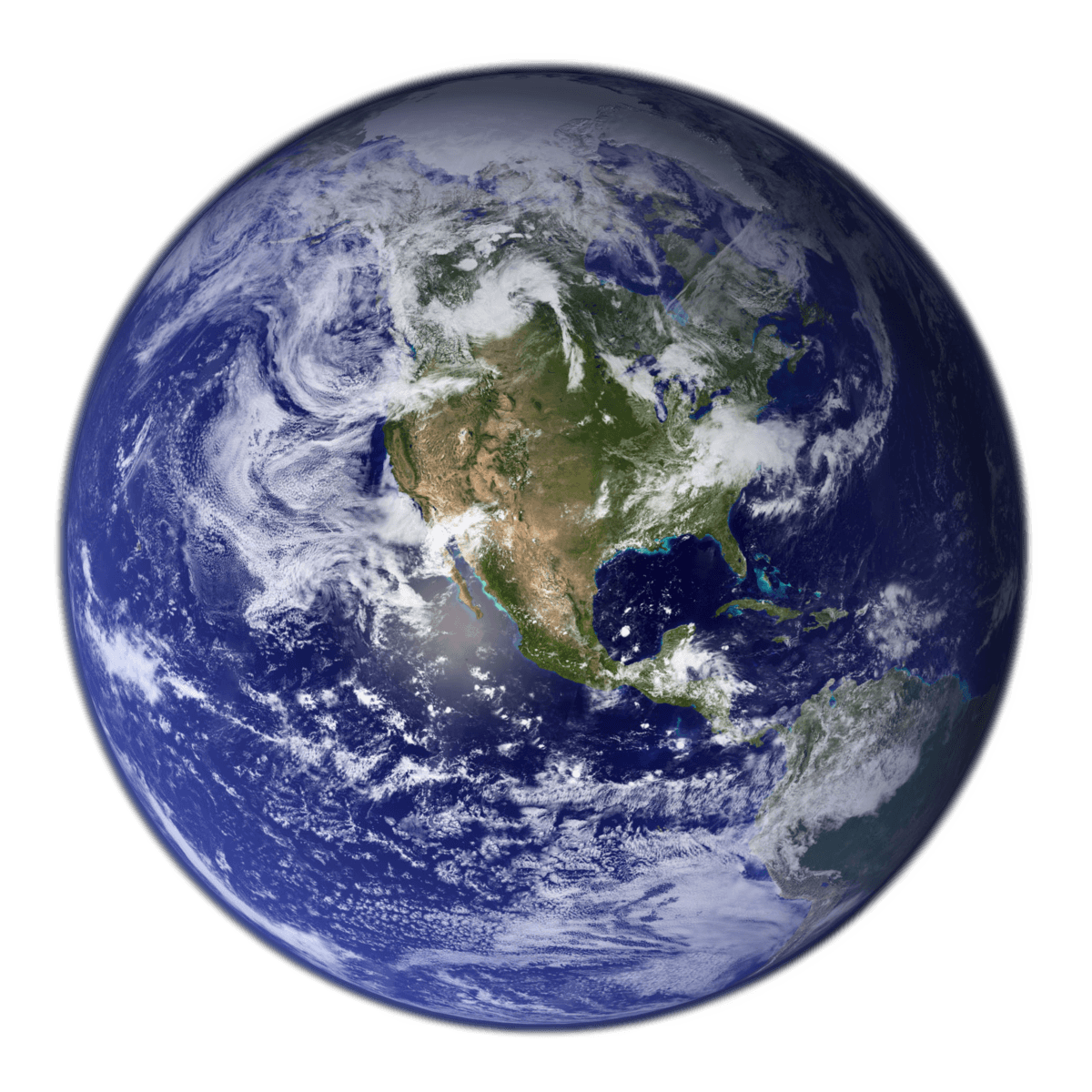
The Equator is the circle of latitude that divides Earth into the Northern and Southern hemispheres. It is an imaginary line located at 0 degrees latitude, about 40,075 km (24,901 mi) in circumference, halfway between the North and South poles.[1] The term can also be used for any other celestial body that is roughly spherical.
In spatial (3D) geometry, as applied in astronomy, the equator of a rotating spheroid (such as a planet) is the parallel (circle of latitude) at which latitude is defined to be 0°. It is an imaginary line on the spheroid, equidistant from its poles, dividing it into northern and southern hemispheres. In other words, it is the intersection of the spheroid with the plane perpendicular to its axis of rotation and midway between its geographical poles. On and near the equator (on Earth), noontime sunlight appears almost directly overhead (no more than about 23° from the zenith) every day, year-round. Consequently, the equator has a rather stable daytime temperature throughout the year. On the equinoxes (approximately 20 March and 23 September) the subsolar point crosses Earth's equator at a shallow angle, sunlight shines perpendicular to Earth's axis of rotation, and all latitudes have nearly a 12-hour day and 12-hour night.
In cartography, a map projection is any of a broad set of transformations employed to represent the curved two-dimensional surface of a globe on a plane. In a map projection, coordinates, often expressed as latitude and longitude, of locations from the surface of the globe are transformed to coordinates on a plane. In cartography, a map projection is any of a broad set of transformations employed to represent the curved two-dimensional surface of a globe on a plane. In a map projection, coordinates, often expressed as latitude and longitude, of locations from the surface of the globe are transformed to coordinates on a plane.
The latitude of the Earth's equator is, by definition, 0° (zero degrees) of arc. The equator is one of the five notable circles of latitude on Earth; the other four are the two polar circles (the Arctic Circle and the Antarctic Circle) and the two tropical circles (the Tropic of Cancer and the Tropic of Capricorn). The equator is the only line of latitude which is also a great circle—meaning, one whose plane passes through the center of the globe. The plane of Earth's equator, when projected outwards to the celestial sphere, defines the celestial equator. In the cycle of Earth's seasons, the equatorial plane runs through the Sun twice a year: on the equinoxes in March and September. To a person on Earth, the Sun appears to travel along the equator (or along the celestial equator) at these times. The equator marked as it crosses Ilhéu das Rolas, in São Tomé and Príncipe The Marco Zero monument marking the equator in Macapá, Brazil Locations on the equator experience the shortest sunrises and sunsets because the Sun's daily path is nearly perpendicular to the horizon for most of the year. The length of daylight (sunrise to sunset) is almost constant throughout the year; it is about 14 minutes longer than nighttime due to atmospheric refraction and the fact that sunrise begins (or sunset ends) as the upper limb, not the center, of the Sun's disk contacts the horizon.
In Australia, areas around the Tropic have some of the world's most variable rainfall.[5] In the east advanced plants such as flowering shrubs and eucalyptus and in most bioregions grasses have adapted to cope with means such as deep roots and little transpiration. Wetter areas, seasonally watered, are widely pasture farmed. As to animals, birds and marsupials are well-adapted. Naturally difficult arable agriculture specialises in dry fruits, nuts and modest water consumption produce. Other types are possible given reliable irrigation sources and, ideally, water-retentive enriched or alluvial soils, especially wheat; shallow irrigation sources very widely dry up in and after drought years. The multi-ridge Great Dividing Range brings relief precipitation enough to make hundreds of kilometres either side cultivable, and its rivers are widely dammed to store necessary water; this benefits the settled areas of New South Wales and Queensland. In Australia, areas around the Tropic have some of the world's most variable rainfall.[5] In the east advanced plants such as flowering shrubs and eucalyptus and in most bioregions grasses have adapted to cope with means such as deep roots and little transpiration. Wetter areas, seasonally watered, are widely pasture farmed. As to animals, birds and marsupials are well-adapted. Naturally difficult arable agriculture specialises in dry fruits, nuts and modest water consumption produce. Other types are possible given reliable irrigation sources and, ideally, water-retentive enriched or alluvial soils, especially wheat; shallow irrigation sources very widely dry up in and after drought years. The multi-ridge Great Dividing Range brings relief precipitation enough to make hundreds of kilometres either side cultivable, and its rivers are widely dammed to store necessary water; this benefits the settled areas of New South Wales and Queensland.
Sharp Earth enables disparate language groups -Latin, Arabic, Indic, Japanese, Greek, Thai, English and various indigenous languages - to appear graphically harmonious while remaining legible and true to their origins.
From crater counts on other celestial bodies, it is inferred that a period of intense meteorite impacts, called the Late Heavy Bombardment, began about 4.1 Ga, and concluded around 3.8 Ga, at the end of the Hadean. In addition, volcanism was severe due to the large heat flow and geothermal gradient. Nevertheless, detrital zircon crystals dated to 4.4 Ga show evidence of having undergone contact with liquid water, suggesting that the Earth already had oceans or seas at that time.By the beginning of the Archean, the Earth had cooled significantly. From crater counts on other celestial bodies, it is inferred that a period of intense meteorite impacts, called the Late Heavy Bombardment, began about 4.1 Ga, and concluded around 3.8 Ga, at the end of the Hadean. In addition, volcanism was severe due to the large heat flow and geothermal gradient. Nevertheless, detrital zircon crystals dated to 4.4 Ga show evidence of having undergone contact with liquid water, suggesting that the Earth already had oceans or seas at that time.By the beginning of the Archean, the Earth had cooled significantly. Present
Z liczby kraterów na innych ciałach niebieskich wnioskuje się, że okres intensywnych uderzeń meteorytów, zwany późnym ciężkim bombardowaniem, rozpoczął się około 4,1 Ga i zakończył około 3,8 Ga na końcu Hadeanu. Ponadto wulkanizm był poważny ze względu na duży przepływ ciepła i gradient geotermalny. Niemniej jednak detrytyczne kryształy cyrkonu datowane na 4,4 Ga wykazują dowody na kontakt z ciekłą wodą, co sugeruje, że na Ziemi istniały już wówczas oceany lub morza. Na początku archaiku Ziemia znacznie się ochłodziła. Z liczby kraterów na innych ciałach niebieskich wnioskuje się, że okres intensywnych uderzeń meteorytów, zwany późnym ciężkim bombardowaniem, rozpoczął się około 4,1 Ga i zakończył około 3,8 Ga na końcu Hadeanu. Ponadto wulkanizm był poważny ze względu na duży przepływ ciepła i gradient geotermalny. Niemniej jednak detrytyczne kryształy cyrkonu datowane na 4,4 Ga wykazują dowody na kontakt z ciekłą wodą, co sugeruje, że na Ziemi istniały już wówczas oceany lub morza. Na początku archaiku Ziemia znacznie się ochłodziła. Obecny
На основании подсчета кратеров на других небесных телах можно сделать вывод, что период интенсивных ударов метеоритов, названный Поздней тяжелой бомбардировкой, начался около 4,1 млрд лет назад и завершился около 3,8 млрд лет назад, в конце Гадея. Кроме того, вулканизм был сильным из-за большого теплового потока и геотермического градиента. Тем не менее, обломочные кристаллы циркона, датированные 4,4 млрд лет, свидетельствуют о контакте с жидкой водой, что позволяет предположить, что на Земле в то время уже были океаны или моря. К началу архея Земля значительно остыла. На основании подсчета кратеров на других небесных телах можно сделать вывод, что период интенсивных ударов метеоритов, названный Поздней тяжелой бомбардировкой, начался около 4,1 млрд лет назад и завершился около 3,8 млрд лет назад, в конце Гадея. Кроме того, вулканизм был сильным из-за большого теплового потока и геотермического градиента. Тем не менее, обломочные кристаллы циркона, датированные 4,4 млрд лет, свидетельствуют о контакте с жидкой водой, что позволяет предположить, что на Земле в то время уже были океаны или моря. К началу архея Земля значительно остыла.
Από τις μετρήσεις κρατήρων σε άλλα ουράνια σώματα, συνάγεται ότι μια περίοδος έντονων κρούσεων μετεωριτών, που ονομάζεται Ύστερος Βαρύς Βομβαρδισμός, ξεκίνησε περίπου στα 4,1 Ga και ολοκληρώθηκε γύρω στα 3,8 Ga, στο τέλος του Αδαίου. Επιπλέον, ο ηφαιστειασμός ήταν σοβαρός λόγω της μεγάλης ροής θερμότητας και της γεωθερμικής κλίσης. Παρόλα αυτά, κρύσταλλοι ζιρκονίου που χρονολογούνται στο 4,4 Ga δείχνουν στοιχεία επαφής με υγρό νερό, υποδηλώνοντας ότι η Γη είχε ήδη ωκεανούς ή θάλασσες εκείνη την εποχή. Από την αρχή του Αρχαίου, η Γη είχε κρυώσει σημαντικά. Από τις μετρήσεις κρατήρων σε άλλα ουράνια σώματα, συνάγεται ότι μια περίοδος έντονων κρούσεων μετεωριτών, που ονομάζεται Ύστερος Βαρύς Βομβαρδισμός, ξεκίνησε περίπου στα 4,1 Ga και ολοκληρώθηκε γύρω στα 3,8 Ga, στο τέλος του Αδαίου. Επιπλέον, ο ηφαιστειασμός ήταν σοβαρός λόγω της μεγάλης ροής θερμότητας και της γεωθερμικής κλίσης. Παρόλα αυτά, κρύσταλλοι ζιρκονίου που χρονολογούνται στο 4,4 Ga δείχνουν στοιχεία επαφής με υγρό νερό, υποδηλώνοντας ότι η Γη είχε ήδη ωκεανούς ή θάλασσες εκείνη την εποχή. Από την αρχή του Αρχαίου, η Γη είχε κρυώσει σημαντικά. Παρόν
จากการนับปล่องภูเขาไฟบนเทห์ฟากฟ้าอื่นๆ สรุปได้ว่าช่วงที่อุกกาบาตพุ่งชนอย่างรุนแรง เรียกว่า การทิ้งระเบิดหนักตอนปลาย (Late Heavy Bombardment) เริ่มต้นประมาณ 4.1 Ga และสรุปที่ประมาณ 3.8 Ga ที่ปลายสุดของฮาเดียน นอกจากนี้ ภูเขาไฟยังมีความรุนแรงเนื่องจากมีความร้อนไหลเข้ามามากและการไล่ระดับความร้อนใต้พิภพ อย่างไรก็ตาม ผลึกเพทายที่เสียหายซึ่งมีอายุถึง 4.4 Ga แสดงหลักฐานของการสัมผัสกับน้ำของเหลว ซึ่งบ่งบอกว่าโลกมีมหาสมุทรหรือทะเลอยู่แล้วในขณะนั้น เมื่อถึงจุดเริ่มต้นของ Archean โลกก็เย็นลงอย่างเห็นได้ชัด ปัจจุบัน จากการนับปล่องภูเขาไฟบนเทห์ฟากฟ้าอื่นๆ สรุปได้ว่าช่วงที่อุกกาบาตพุ่งชนอย่างรุนแรง เรียกว่า การทิ้งระเบิดหนักตอนปลาย (Late Heavy Bombardment) เริ่มต้นประมาณ 4.1 Ga และสรุปที่ประมาณ 3.8 Ga ที่ปลายสุดของฮาเดียน นอกจากนี้ ภูเขาไฟยังมีความรุนแรงเนื่องจากมีความร้อนไหลเข้ามามากและการไล่ระดับความร้อนใต้พิภพ อย่างไรก็ตาม ผลึกเพทายที่เสียหายซึ่งมีอายุถึง 4.4 Ga แสดงหลักฐานของการสัมผัสกับน้ำของเหลว ซึ่งบ่งบอกว่าโลกมีมหาสมุทรหรือทะเลอยู่แล้วในขณะนั้น เมื่อถึงจุดเริ่มต้นของ Archean โลกก็เย็นลงอย่างเห็นได้ชัด ปัจจุบัน
من خلال تعداد الحفر على الأجرام السماوية الأخرى، يُستنتج أن فترة من التأثيرات النيزكية الشديدة، تسمى القصف الثقيل المتأخر، بدأت حوالي 4.1 مليار سنة، وانتهت حوالي 3.8 مليار سنة، في نهاية العصر الهادياني. بالإضافة إلى ذلك، كانت البراكين شديدة بسبب التدفق الحراري الكبير والتدرج الحراري الأرضي. ومع ذلك، فإن بلورات الزركون الفتاتية التي يرجع تاريخها إلى 4.4 مليار سنة تظهر دليلاً على تعرضها للتلامس مع الماء السائل، مما يشير إلى أن الأرض كانت تحتوي بالفعل على محيطات أو بحار في ذلك الوقت. وبحلول بداية العصر الأركي، كانت الأرض قد بردت بشكل ملحوظ. حاضر من خلال تعداد الحفر على الأجرام السماوية الأخرى، يُستنتج أن فترة من التأثيرات النيزكية الشديدة، تسمى القصف الثقيل المتأخر، بدأت حوالي 4.1 مليار سنة، وانتهت حوالي 3.8 مليار سنة، في نهاية العصر الهادياني. بالإضافة إلى ذلك، كانت البراكين شديدة بسبب التدفق الحراري الكبير والتدرج الحراري الأرضي. ومع ذلك، فإن بلورات الزركون الفتاتية التي يرجع تاريخها إلى 4.4 مليار سنة تظهر دليلاً على تعرضها للتلامس مع الماء السائل، مما يشير إلى أن الأرض كانت تحتوي بالفعل على محيطات أو بحار في ذلك الوقت. وبحلول بداية العصر الأركي، كانت الأرض قد بردت بشكل ملحوظ. حاضر
अन्य खगोलीय पिंडों पर क्रेटर गणना से, यह अनुमान लगाया जाता है कि तीव्र उल्कापिंड प्रभावों की अवधि, जिसे लेट हेवी बॉम्बार्डमेंट कहा जाता है, लगभग 4.1 Ga में शुरू हुई और हेडियन के अंत में 3.8 Ga के आसपास समाप्त हुई। इसके अलावा, बड़े ताप प्रवाह और भूतापीय प्रवणता के कारण ज्वालामुखी गंभीर था। फिर भी, 4.4 Ga के डेट्राइटल जिरकोन क्रिस्टल तरल पानी के संपर्क में आने का प्रमाण दिखाते हैं, जिससे पता चलता है कि उस समय पृथ्वी पर पहले से ही महासागर या समुद्र थे। आर्कियन की शुरुआत तक, पृथ्वी काफी हद तक ठंडी हो गई थी। उपस्थित अन्य खगोलीय पिंडों पर क्रेटर गणना से, यह अनुमान लगाया जाता है कि तीव्र उल्कापिंड प्रभावों की अवधि, जिसे लेट हेवी बॉम्बार्डमेंट कहा जाता है, लगभग 4.1 Ga में शुरू हुई और हेडियन के अंत में 3.8 Ga के आसपास समाप्त हुई। इसके अलावा, बड़े ताप प्रवाह और भूतापीय प्रवणता के कारण ज्वालामुखी गंभीर था। फिर भी, 4.4 Ga के डेट्राइटल जिरकोन क्रिस्टल तरल पानी के संपर्क में आने का प्रमाण दिखाते हैं, जिससे पता चलता है कि उस समय पृथ्वी पर पहले से ही महासागर या समुद्र थे। आर्कियन की शुरुआत तक, पृथ्वी काफी हद तक ठंडी हो गई थी। उपस्थित
古代になり、文字で記録や歴史が残される時代になっても、星の研究はもっぱら肉眼で行われた。しかし文明が発達するとともに、バビロニア・中国・エジプト・ギリシア・インド・中央アメリカなどで天文台が建設され、宇宙の根元についての考察が発展を始めた。ほとんどの初期天文学は、恒星や惑星の位置を記す、現在では位置天文学と呼ばれるものだった。これらの観測から、惑星の挙動に対する最初のアイデアが形成され、宇宙における太陽・月そして地球の根源が哲学的に探求された。「地球は宇宙の中心にあり、太陽・月・星々が周囲を廻っている」と考えられた。この考え方は、クラウディオス・プトレマイオスから名を取って「プトレマイック・システム (Ptolemaic System)」と呼ばれる。