Alpes Mono
Lorsqu'il est utilisé dans le cadre d'un itinéraire, il peut faire l'objet d'une signalétique particulière sous la forme d'un balisage par un marquage à la peinture complété ou non par des panneaux indicateurs qui précisent le lieu à atteindre et, parfois, l'horaire. Les refuges et autres services pour randonneurs se trouvent généralement à proximité des sentiers. En montagne et dans les zones isolées, il fait office d'axe de communication essentiel. Ils sont aussi très empruntés lors de certains pèlerinages ou événements comme les chemins de Compostelle en Europe, celui menant au Bromo en Indonésie ou encore ceux gravissant le mont Fuji au Japon.
Night came quickly, and, rather than risk a fall in the dark, I decided to spend the night bivouacked not far below the summit on a small platform I scraped away in the snow. My oxygen soon ran out, and I faced 50 mph winds and temperatures of 35 below. I concentrated my mind on survival. I realized my violent shivers meant I was in the early stages of hypothermia. Though I could no longer feel my toes, I tried wiggling them anyway: tensing, relaxing, tensing, relaxing. “Move, move, move – keep the circulation going.” Somehow I made it through the night. No one had ever survived a solo bivouac above 27,000ft. Beyond cold and hypoxic, the next morning I resumed my descent. At the top of a section called the Bottleneck, I encountered John Roskelley and Rick Ridgeway on their way up our route, having abandoned the Polish finish due to avalanche danger. Night came quickly, and, rather than risk a fall in the dark, I decided to spend the night bivouacked not far below the summit on a small platform I scraped away in the snow. My oxygen soon ran out, and I faced 50 mph winds and temperatures of 35 below. I concentrated my mind on survival. I realized my violent shivers meant I was in the early stages of hypothermia. Though I could no longer feel my toes, I tried wiggling them anyway: tensing, relaxing, tensing, relaxing. “Move, move, move – keep the circulation going.” Somehow I made it through the night. No one had ever survived a solo bivouac above 27,000ft. Beyond cold and hypoxic, the next morning I resumed my descent. At the top of a section called the Bottleneck, I encountered John Roskelley and Rick Ridgeway on their way up our route, having abandoned the Polish finish due to avalanche danger.
Around the same time, my interest was piqued by an old black-and-white photo of K2 in a history of Himalayan mountaineering. With its perfect, conelike shape, K2 called to me as Everest never did. In high school leafing through a history of Himalayan expeditions, I saw a photograph of the mountain, as steep and symmetrical as an Egyptian pyramid, and dreamed of one day climbing it. I am still struck by how this image foreshadowed the very route that Lou Reichardt, Terry Bech, and I took in September 1978 to the summit of K2, ploughing our way through deep snow from one side of the mountain to the other to establish Camp 6 at 25,800 feet. That traverse enabled us to link up with the Abruzzi route taken by the Italians in 1954 on the first ascent of the mountain. Around the same time, my interest was piqued by an old black-and-white photo of K2 in a history of Himalayan mountaineering. With its perfect, conelike shape, K2 called to me as Everest never did. In high school leafing through a history of Himalayan expeditions, I saw a photograph of the mountain, as steep and symmetrical as an Egyptian pyramid, and dreamed of one day climbing it. I am still struck by how this image foreshadowed the very route that Lou Reichardt, Terry Bech, and I took in September 1978 to the summit of K2, ploughing our way through deep snow from one side of the mountain to the other to establish Camp 6 at 25,800 feet. That traverse enabled us to link up with the Abruzzi route taken by the Italians in 1954 on the first ascent of the mountain.

K2, also known as Mount Godwin-Austen, at 8,611 metres (28,251 ft) above sea level, is the second-highest mountain on Earth, after Mount Everest at 8,849 metres (29,032 ft). It lies in the Karakoram range, partially in the Gilgit-Baltistan region of Pakistan-administered Kashmir and partially in the China-administered Trans-Karakoram Tract in the Taxkorgan Tajik Autonomous County of Xinjiang. K2 became known as the Savage Mountain after George Bell—a climber on the 1953 American expedition—said, "It's a savage mountain that tries to kill you."
On the 1954 Italian expedition to K2 (led by Ardito Desio), Achille Compagnoni and Lino Lacedelli became the first people to reach the summit of K2, 8,611 metres (28,251 ft), the second-highest mountain in the world. They reached the summit on 31 July 1954. K2 is more difficult to climb than Mount Everest, 8,849 metres (29,032 ft), which had first been climbed by a British expedition in 1953. Three earlier unsuccessful American attempts on the mountain had identified a good route to use. Desio felt Italy's earlier exploration of the Karakoram region gave good reason to mount a major expedition which he did on a grand scale, following the American route up the south-east ridge. Progress towards the summit was repeatedly interrupted by storms, and one member of the team died rather unexpectedly. On the 1954 Italian expedition to K2 (led by Ardito Desio), Achille Compagnoni and Lino Lacedelli became the first people to reach the summit of K2, 8,611 metres (28,251 ft), the second-highest mountain in the world. They reached the summit on 31 July 1954. K2 is more difficult to climb than Mount Everest, 8,849 metres (29,032 ft), which had first been climbed by a British expedition in 1953. Three earlier unsuccessful American attempts on the mountain had identified a good route to use. Desio felt Italy's earlier exploration of the Karakoram region gave good reason to mount a major expedition which he did on a grand scale, following the American route up the south-east ridge. Progress towards the summit was repeatedly interrupted by storms, and one member of the team died rather unexpectedly.
The Club Alpino Italiano is the senior Italian alpine club which stages climbing competitions, operates alpine huts, marks and maintains paths, and is active in protecting the Alpine environment. It was founded in Turin in 1863 by the then finance minister, and mountaineer, Quintino Sella; together with the Swiss Alpine Club, founded in the same year, it is the second-oldest Alpine Club in the world, only preceded by the British Alpine Club. After First World War and the annexation of Trento and Trieste to Italy, it absorbed the "Società degli Alpinisti Tridentini" and the "Società Alpina delle Giulie". As of 2020, it had 306.255 members, 512 sections and 316 sub-sections, the greatest numbers of members came from Lombardy (88,057), Veneto (54,948), and Piedmont (51,396). The Club Alpino Italiano is the senior Italian alpine club which stages climbing competitions, operates alpine huts, marks and maintains paths, and is active in protecting the Alpine environment. It was founded in Turin in 1863 by the then finance minister, and mountaineer, Quintino Sella; together with the Swiss Alpine Club, founded in the same year, it is the second-oldest Alpine Club in the world, only preceded by the British Alpine Club. After First World War and the annexation of Trento and Trieste to Italy, it absorbed the "Società degli Alpinisti Tridentini" and the "Società Alpina delle Giulie". As of 2020, it had 306.255 members, 512 sections and 316 sub-sections, the greatest numbers of members came from Lombardy (88,057), Veneto (54,948), and Piedmont (51,396).
A bivouac shelter or bivvy (alternately bivy, bivi, bivvi) is any of a variety of improvised camp site or shelter that is usually of a temporary nature, used especially by soldiers or people engaged in backpacking, bikepacking, scouting or mountain climbing. It may often refer to sleeping in the open with a bivouac sack, but it may also refer to a shelter constructed of natural materials like a structure of branches to form a frame, which is then covered with leaves, ferns and similar material for waterproofing and duff (leaf litter) for insulation. Modern bivouacs often involve the use of one- or two-person tents but may also be without tents or full cover.
The ascent of Nanga Parbat on 3 July 1953 is Buhl's most famous summit victory. It took place as part of the Willy Merkl Memorial Expedition, organized by the Munich doctor Karl Herrligkoffer and led in conjunction with Peter Aschenbrenner as mountaineering leader. Buhl, helped by a change in the weather after an initial monsoon, reached Camp V at 6,900 m on July 2 together with Walter Frauenberger,Hans Ertl and Otto Kempter, where he and Kempter spent the night while the other two descended with the porters to Camp IV. Buhl set off for the summit single-handedly and without additional oxygen at around 02:30 in the night and finally reached it with his last ounce of strength at around 19:00. As proof of his ascent, Hermann Buhl left his ice axe and the Pakistani flag at the summit. Kempter, who had followed an hour later, had had to give up at an altitude of around 7,400 m on the plateau at the Silbersattel due to a bout of weakness and had returned to Camp V.
Just a few weeks after the successful first ascent of Broad Peak, Buhl and Diemberger made an attempt on nearby, unclimbed Chogolisa (7665 m) in Alpine style. Buhl lost his way in an unexpected snow storm and walked over a huge cornice on the East Ridge, near the summit of Chogolisa II (7654 m; also known as Bride Peak), subsequently triggering an avalanche that hurled him down 900 m over Chogolisa's Northeast Face. His body could not be recovered and remains in the ice.[17] On the basis of a photo of the crash site taken by Diemberger, it can be seen from the footprint in the snow that Buhl had probably briefly lost his bearings in the snowstorm and got too close to the edge of the cornice, whereupon the cornice gave way under his weight. Buhl and Diemberger made an attempt on nearby, unclimbed Chogolisa (7665 m) in Alpine style. Buhl lost his way in an unexpected snow storm and walked over a huge cornice on the East Ridge, near the summit of Chogolisa II (7654 m; also known as Bride Peak), subsequently triggering an avalanche that hurled him down 900 m over Chogolisa's Northeast Face.
iiiiii

The Karakoram begins in the Wakhan Corridor in western Afghanistan and extends eastwards into Indian-administered Ladakh and Chinese-administered Aksai Chin, as well as the Chinese province of Xinjiang. Most of the Karakoram is located within the Pakistani-administered Gilgit-Baltistan region. The Karakoram is bounded on the east by the Aksai Chin plateau, on the north-east by the edge of the Tibetan Plateau, and on the north by the river valleys of the Yarkand and Karakash rivers, beyond which lie the Kunlun Mountains. At the north-west corner are the Pamir Mountains.
DMS
Decimal35° 52′ 57″ N, 76° 30′ 48″ E
35.8825, 76.513333Geo URIgeo:35.8825,76.513333UTM43S 636600 3971974 Type mountain Region CN Article Karakoram
DMS
Decimal46° 41′ 0″ N, 7° 51′ 0″ E
46.683333, 7.85Geo URIgeo:46.683333,7.85UTM32T 412056 5170617 Type city Region CH-BE Article Interlaken
DMS
Decimal46° 50′ 24″ N, 7° 36′ 0″ E
46.84, 7.6 Geo URIgeo:46.84,7.6UTM32T 393248 5188336 Type city Region CH-BE Article Canton of Bern
When I’m asked about the significance of our climb in the larger context of mountaineering history, I think it will stand as one of the important early ascents of K2, marking the first non-Abruzzi route to be completed on the mountain, and the first oxygenless ascent. I am glad we were able to pull off an alpine-style finish from Camp 5 to the summit without the use of fixed ropes, now common on the summit pyramid. Remarkably, we shunned the use of climbing ropes going to the summit, save for one linking Lou Reichardt and me, which we discarded at 27,300ft to explore alternatives to the deep snow that greatly slowed our progress. The Karakoram begins in the Wakhan Corridor in western Afghanistan and extends eastwards into Indian-administered Ladakh and Chinese-administered Aksai Chin, as well as the Chinese province of Xinjiang. Most of the Karakoram is located within the Pakistani-administered Gilgit-Baltistan region. The Karakoram is bounded on the east by the Aksai Chin plateau, on the north-east by the edge of the Tibetan Plateau, and on the north by the river valleys of the Yarkand and Karakash rivers, beyond which lie the Kunlun Mountains. At the north-west corner are the Pamir Mountains.
While some scattered Neolithic flint objects, early Bronze Age swords and Roman era coins have been found near Interlaken, there is no evidence for a settlement in the area before the Middle Ages. Interlaken Monastery was built around 1133 on imperial land on the left side of the Aare. The monastery controlled a bridge over the river and generated an income from tolls. A village grew up around the monastery, along with a mill (which gave the municipality its name until 1891). On the right bank of the river, Interlaken village developed. In 1279/80 the village of Unterseen developed near Interlaken village. Also near the village were the imperial castle of Weissenau and the market town of Widen. The castle and market town became the possessions of the monastery, but fell into disrepair in the Late Middle Ages
The town is principally a base from which to explore the surrounding areas. Among the main attractions are the mountains of the Jungfrau region, including the Jungfrau, (4,158 m (13,642 ft)), the Mönch (4,107 m (13,474 ft)) and the Eiger (3,967 m (13,015 ft)). Whilst the peaks of these mountains are accessible only to mountaineers, a sequence of connecting mountain railways gives access to the Jungfraujoch, a saddle (3,454 m (11,332 ft)) between the Jungfrau and the Mönch, but correctly translated as a yoke (German: Joch), which is the highest point in Europe reachable by train. Closer to Interlaken, the Harderkulm (1,321 m (4,334 ft)), just to the north of the town, and the Schynige Platte (1,967 m (6,453 ft)), just to the south, are also accessible by railway and provide extensive views of the higher mountains. Lake Thun and Lake Brienz are both close to the town, and the Aare flows east to west through the town. Boat trips operate on both lakes, serving various lakeside towns. One of these, Brienz, is the starting point for one of Switzerland's last remaining steam operated mountain railway, the Brienz Rothorn Railway.
The Alte Krone/La vieille Couronne, the artist's studio Atelier Robert, the former Rockhall Manor, the main train station, the Jordi-Kocher House, the Catholic parish Church of St. Maria Immaculata, the Kongresshaus/Palais des Congrès (Convention Center), the Kontrollgebäude at Zentralstrasse 49 / Oberer Quai 2, the Neuhaus Museum with the Robert Foundation Collection, the Schwab Museum, the Swiss Reformed City Church, the administration building and montage hall for General Motors, the Volkshaus Building and the Waldleute Zunft Building are listed as Swiss heritage site of national significance. The entire town of Biel/Bienne and the Taubenlochschlucht canyon are both part of the Inventory of Swiss Heritage Sites. the Swiss Reformed City Church, the administration building and montage hall for General Motors, the Volkshaus Building and the Waldleute Zunft Building are listed as Swiss heritage site of national significance. The entire town of Biel/Bienne and the Taubenlochschlucht canyon are both part of the Inventory of Swiss Heritage Sites.
ffffff
The center of the Old Town is located at the top of the hill, accessed by the steeply winding Rue du Château. The Collégiale church, begun in 1185 and consecrated in 1276, is an example of early Gothic. The east end of the church has three Norman apses. The main entrance, to the west, is crowned by a giant rose window of stained glass. Within the vaulted interior, the transept is lit by a lantern tower. The Cenotaph of the Counts of Neuchâtel is located on the north wall of the choir. Begun in 1372, and the only artwork of its kind to survive north of the Alps, the monument comprises fifteen near-life-size painted statues of various knights and ladies from Neuchâtel's past, framed by 15th-century arches and gables.
111111
000000
La Tène culture's territorial extent corresponded to what is now France, Belgium, Switzerland, Austria, England, Southern Germany, the Czech Republic, Northern Italy and Central Italy, Slovenia, Hungary and Liechtenstein, as well as adjacent parts of the Netherlands, Slovakia, Serbia, Croatia, Transylvania (western Romania), and Transcarpathia (western Ukraine). The Celtiberians of western Iberia shared many aspects of the culture, though not generally the artistic style. To the north extended the contemporary Pre-Roman Iron Age of Northern Europe, including the Jastorf culture of Northern Germany and Denmark and all the way to Galatia in Asia Minor (today Turkey). La Tène culture's territorial extent corresponded to what is now France, Belgium, Switzerland, Austria, England, Southern Germany, the Czech Republic, Northern Italy and Central Italy, Slovenia, Hungary and Liechtenstein, as well as adjacent parts of the Netherlands, Slovakia, Serbia, Croatia, Transylvania (western Romania), and Transcarpathia (western Ukraine).
The funicular was built in 1887, by Pümpin, Herzog & Cie of Bern, for the Drahtseilbahn-Gesellschaft Biel-Magglingen. As built it was a water powered line, with a Riggenbach rack rail for braking. The line had a three-rail layout, with the two cars sharing the centre rail, and a central passing loop. It was rebuilt by Von Roll in 1923, still with water power but with an increase in water capacity. The line was rebuilt again by Von Roll in 1954, when it was converted to electrical operation, the Riggenbach rack rail removed, and the three-rail sections replaced by conventional single track. In 2000, the owning company merged with the owners of the nearby Bienne–Evilard Funicular to form FUNIC AG. In 2001 the line was completely renovated by Doppelmayr, with new panoramic cars. In 2014, FUNIC AG was acquired by the VB/TPB. The funicular was built in 1887, by Pümpin, Herzog & Cie of Bern, for the Drahtseilbahn-Gesellschaft Biel-Magglingen. As built it was a water powered line, with a Riggenbach rack rail for braking. The line had a three-rail layout, with the two cars sharing the centre rail,
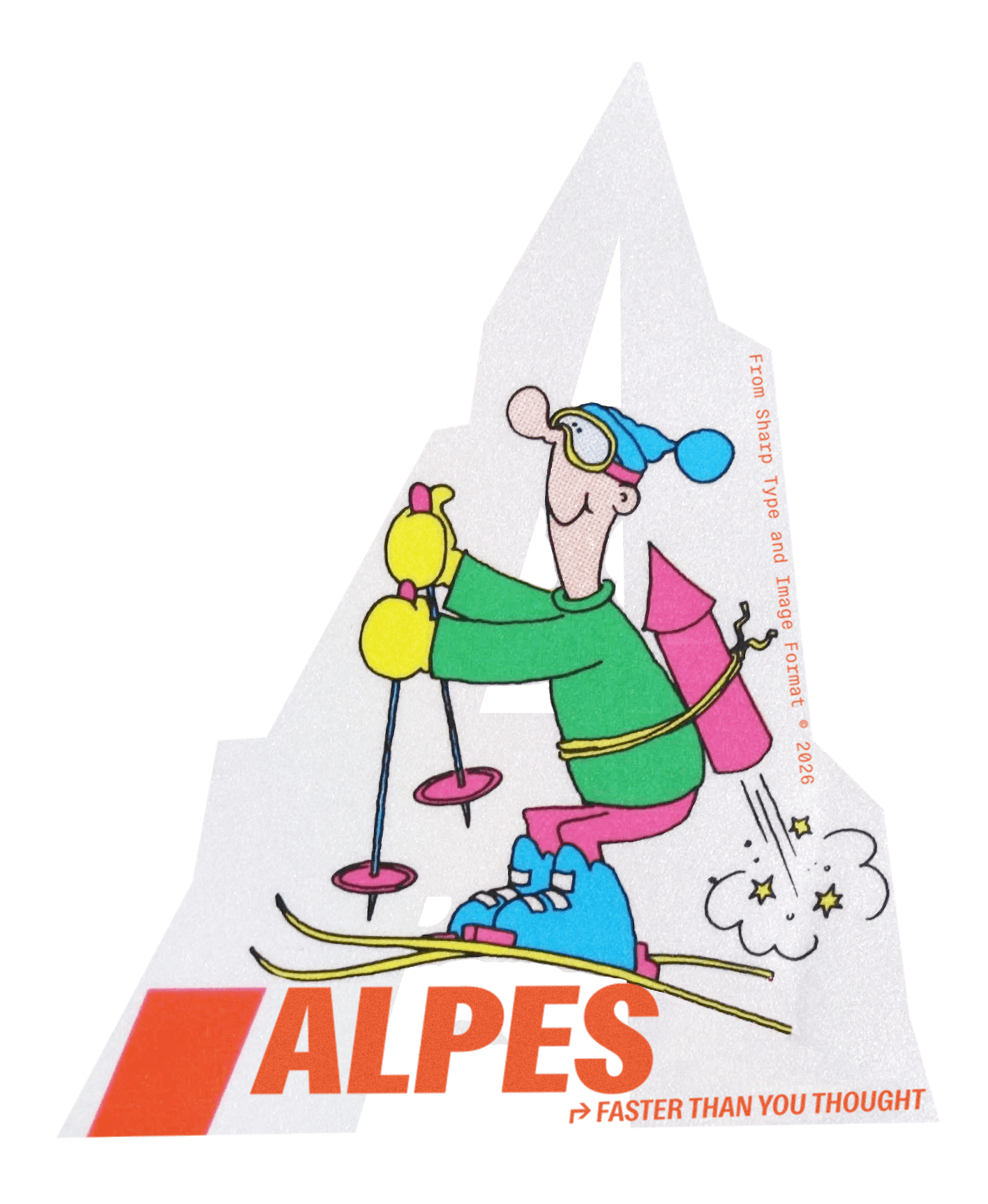
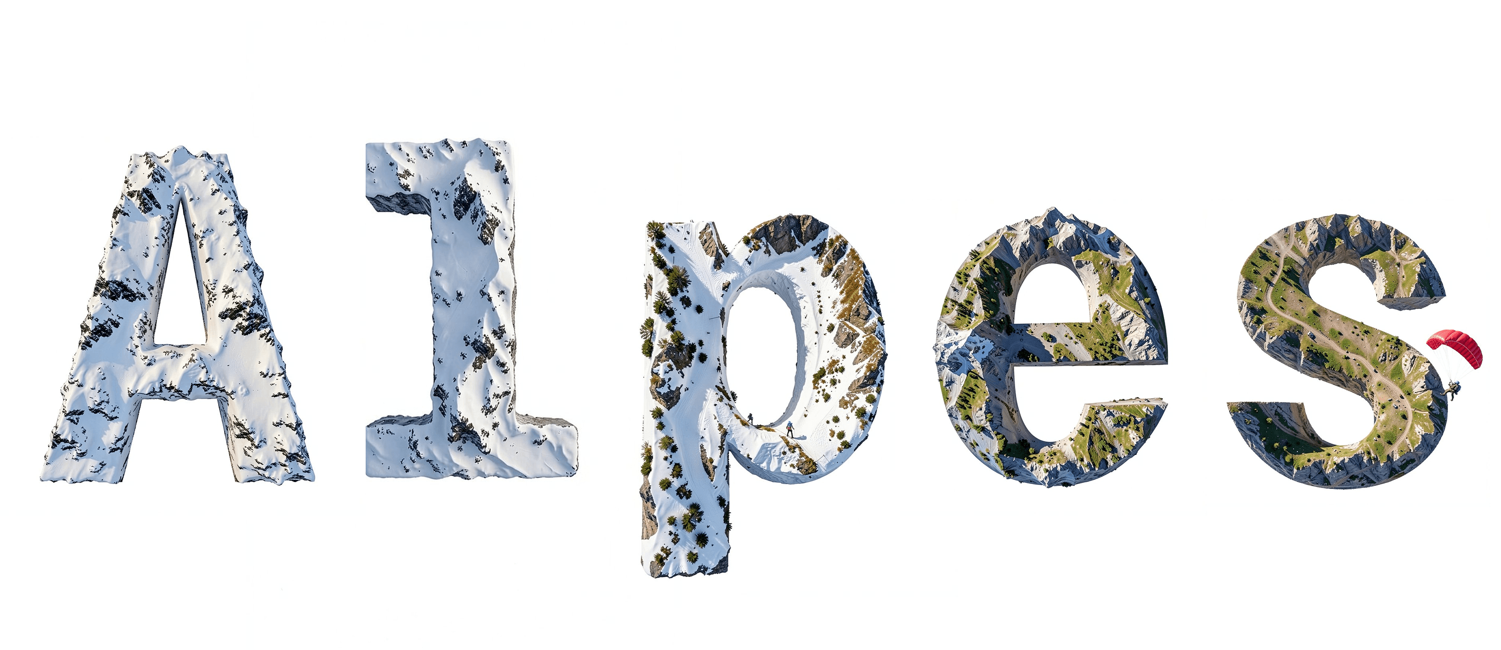
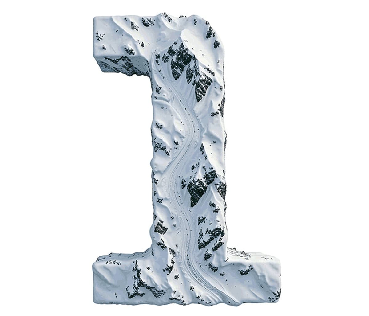
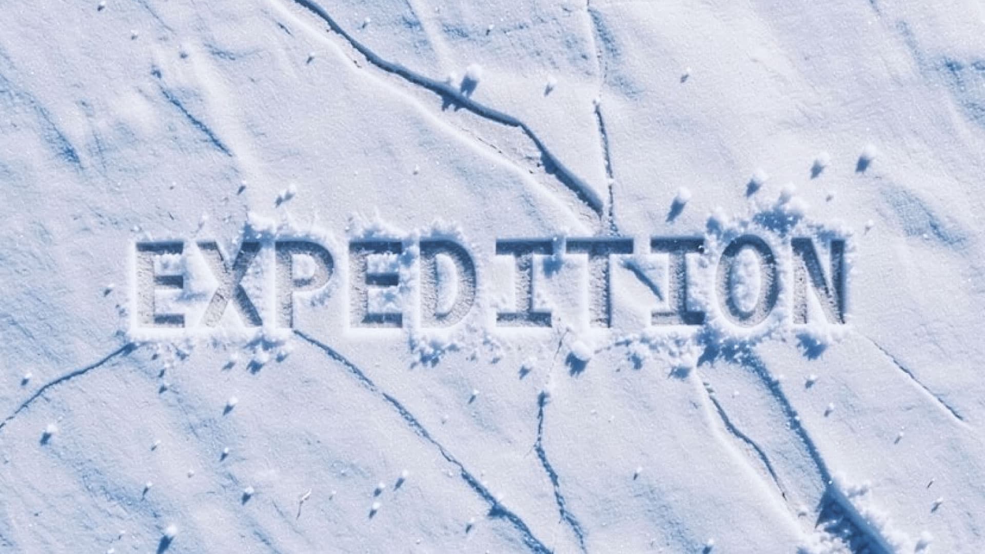
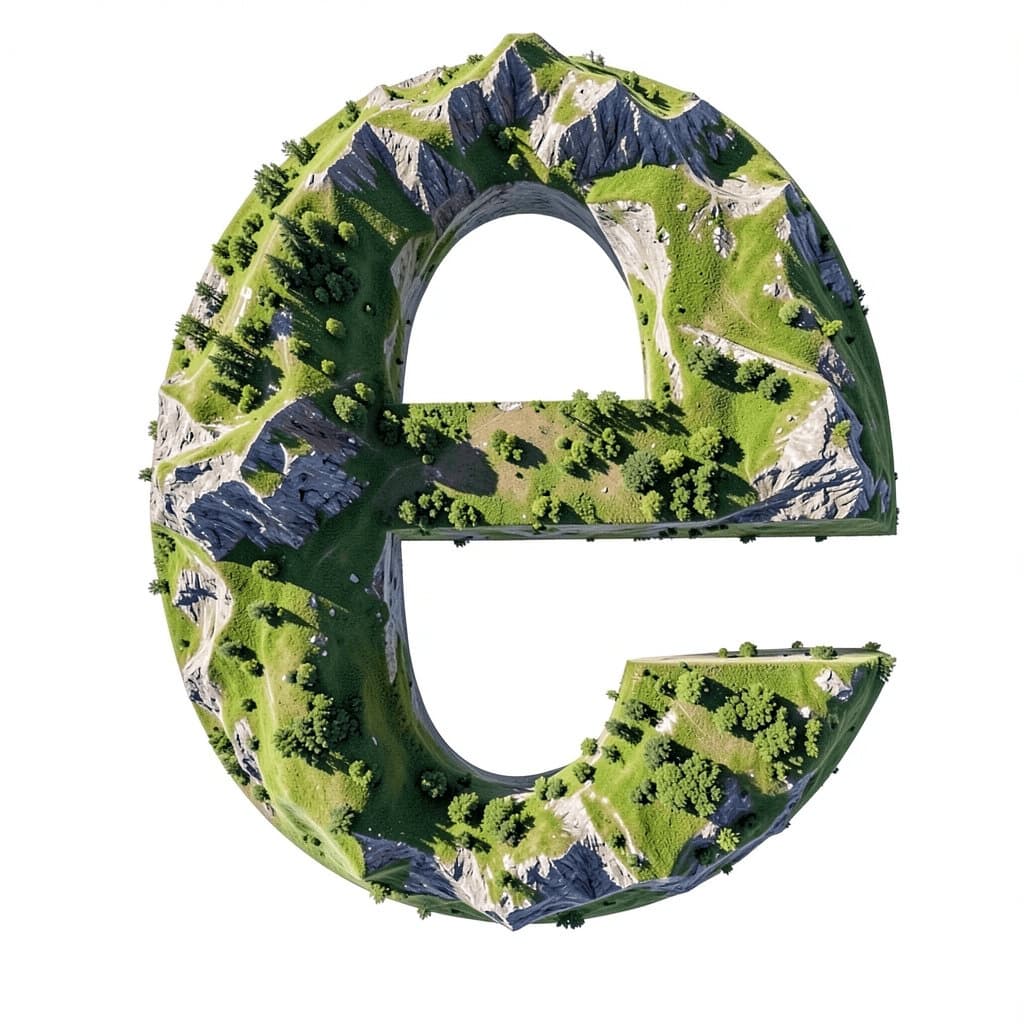
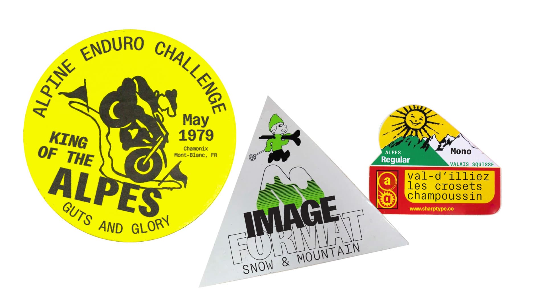
Alpes is a condensed grotesque superfamily offered in sans and mono styles in six weights. The second joint venture between Sharp Type and Image Format, Alpes arose on the bedrock principles of contrasted grotesques, but its final form is an adventurous departure: a pristine, all-terrain typeface sculpted by and for designers that ultimately extends the tradition of its genre forebears into liminal space, opting for distinction without sacrificing readability or quality.